Alps
23 items found
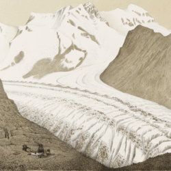
Agassiz, L.
Untersuchungen über die Gletscher. [Complete text and atlas].
Solothurn, Jent & Gassmann, 1840-1841; Neuchatel, H. Nicolet, 1840. Text: 8vo (21.5 x 14.2 cm). xii, 326, [i] pp. 19th-century pebbled half cloth over marbled boards. Spine with gilt ornamental bands and title. Greenish endpapers. Subtly marbled edges. Atlas: Oblong folio (29.7 x 44.0 cm). 18 lithographed plates of which 14 with printed overlays (as intended). Contemporary green quarter calf over green boards. Spine with gilt bands. Original pictorial title mounted on front board.
Read more
Allemann, F.
Geologische Karte Fürstentum Liechtenstein.
[Vaduz], Regierung des Fürstentums Liechtenstein, 1953. Large (102.0 x 67.0 cm), folded map, consisting of 25 rectangular sheets in full colour, mounted on linen. Handwritten and stamped label on the front-facing part of the linen map verso.
Read more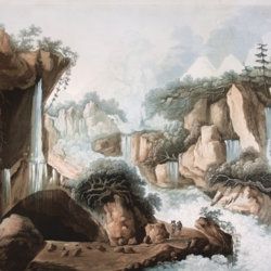
Belanger, L. and P. Vanlerberghe and S. Malgo
View of the torrent of the Lutschinen, and of the glaciers where it takes its source – Vue du torrent de la Lutschinen en Suisse, et des glaciers ou il prend sa source.
London, G. & W. Nicoll, 1800. Broadsheet (71.0 x 56.0 cm). Aquatint, finished by hand.
Read more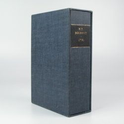
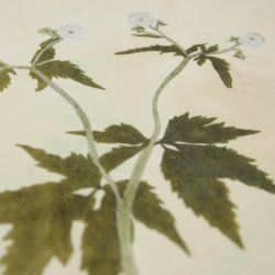
Bourrit, M. T.
Description des Alpes, Pennines et Rhetiennes; dédiée a.s.m. très-chrétienne Louis XVI, roi de France et de Navarre. Tome premier - second. [Complete].
Genève, J. P. Bonnant, 1781. In two volumes. 8vo (21.5 x 13.8 cm). xix, 247 pp.; [ii], 285 pp.; eight engraved plates, mainly of glaciers, and one folded engraved map of the Alps, several wood engraved vignettes in the text. Original uniform blind publishers' wrappers. Spines renewed with later printed labels. Contained in a later blue cloth slipcase (23.2 x 15.8 x 6.9 cm) with black morocco label with gilt title.
Read more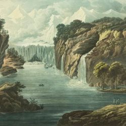

Forbes, J. D.
Reisen in den Savoyer Alpen und in anderen Theilen der Penninen-Kette, nebst Beobachtungen über die Gletscher.
Stuttgart, Schweizerbart, 1845. 8vo (21.0 x 13.3 cm). xii, 386 pp.; seven lithographed plates (of which one hand-coloured) and two folded lithographed maps depicting the Chamonix Alps. Early 20th-century cloth with mounted title and backstrip from original printed boards and spine.
Read more
Fuchs, W.
Die Venetianer Alpen. Ein Beitrag zur Kenntniss der Hochgebirgte, met einen geognostischen Karte und Gebirgteprofilen in achtzehn Tafeln.
Solothurn, Jent & Gassmann, 1844. Oblong folio (29.8 x 35.5 cm), [4], 60 pp.; 18 mostly hand-coloured engraved maps and plates. Text pages bordered with putti and goddesses. 19th century iridescent blue blind cloth.
Read more

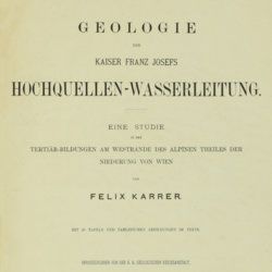
Karrer, F.
Geologie der Kaiser Franz Josefs Hochquellen-Wasserleitung. Eine Studie in den Tertiär-Bildungen am Westrande des alpinen Theiles der Niederung von Wien.
Wien, Hölder, 1877. Large 4to (33.5 x 25.5 cm). xiii, 420 pp.; 96 text engravings, 20 folded profiles, maps and lithographed plates, mostly coloured and several very large (size up to 32 x 100 cm), seven folded charts and tables. Later half cloth with paper label on the spine.
Read more