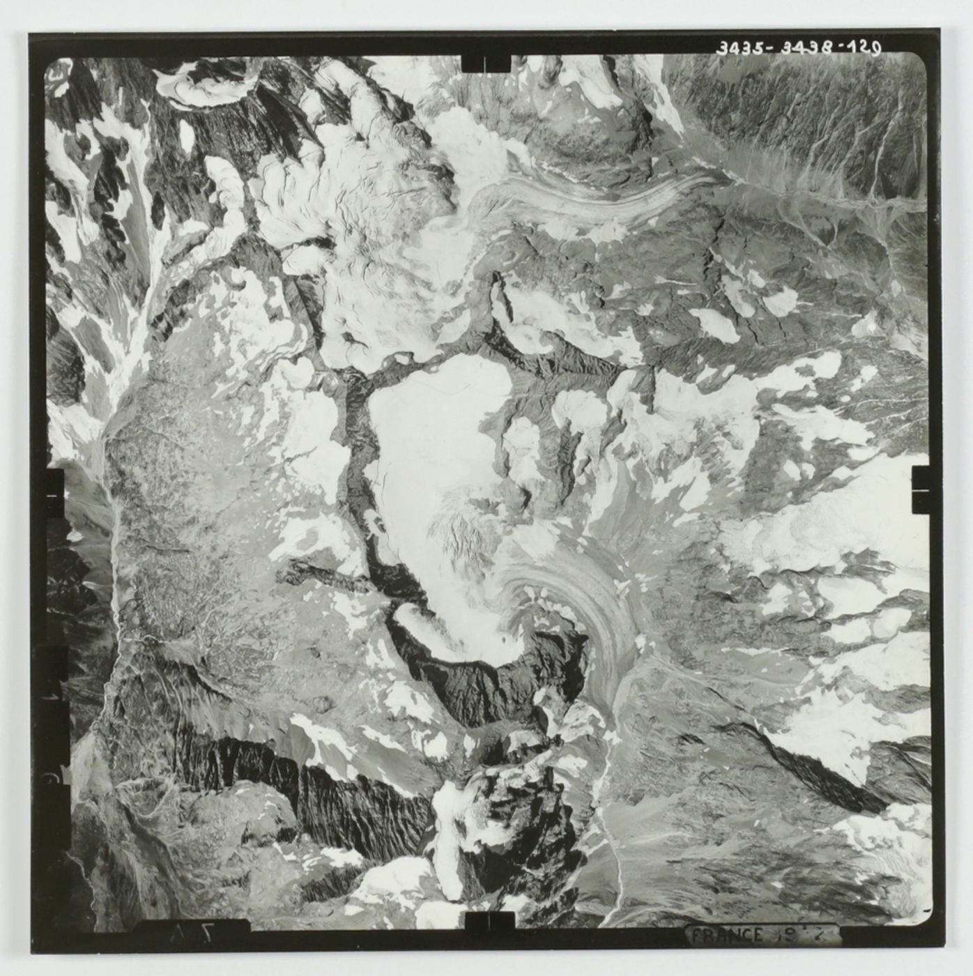
[Aerial photos]
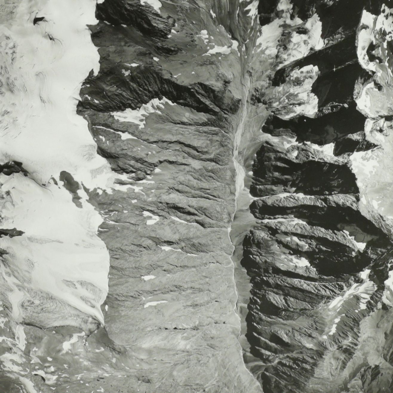
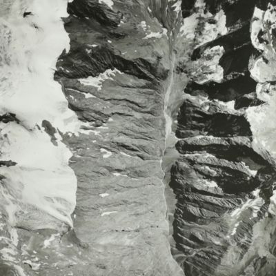
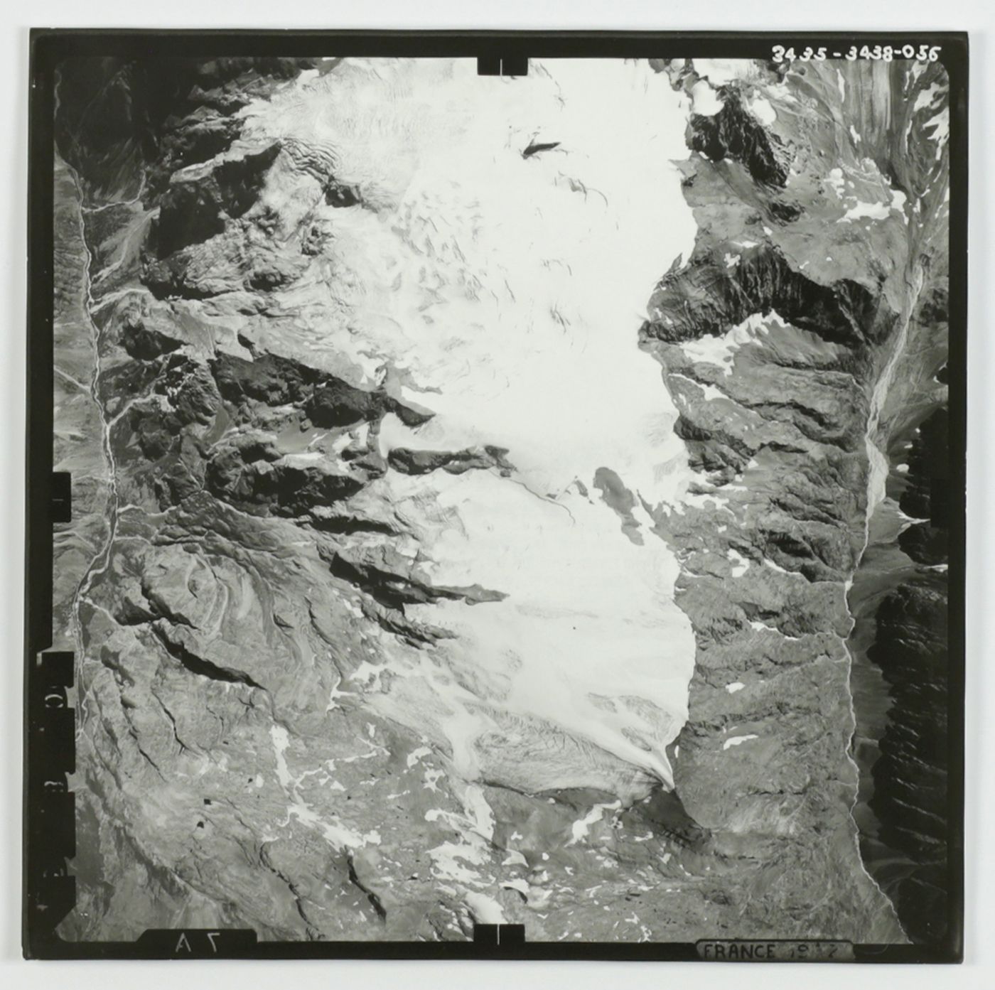
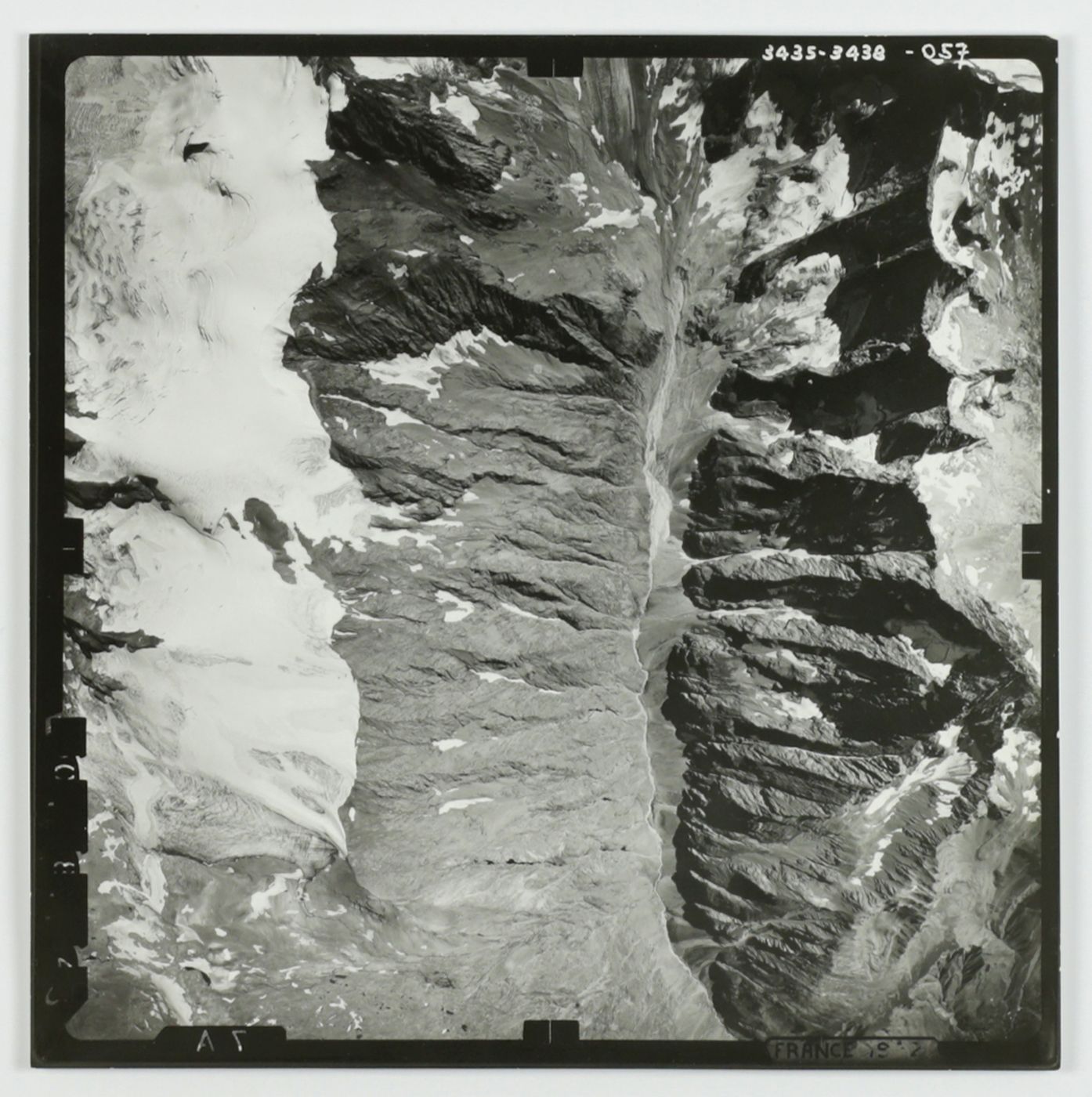
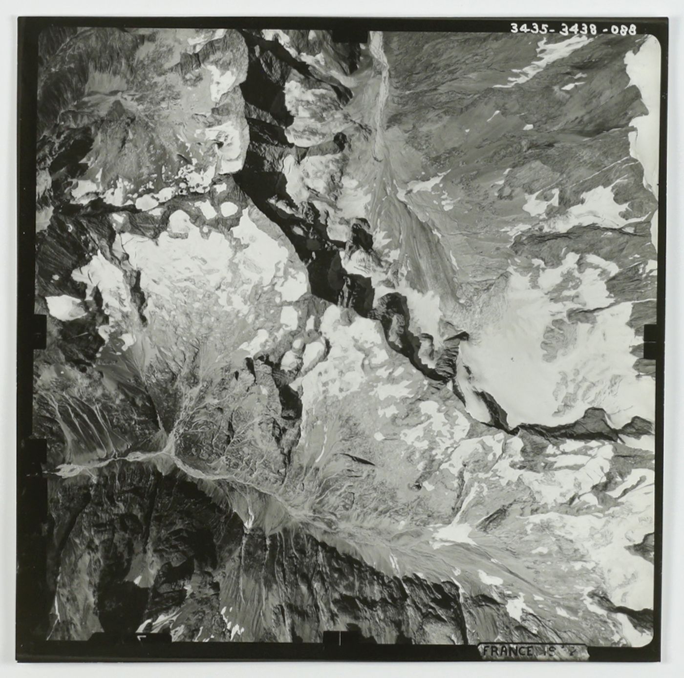
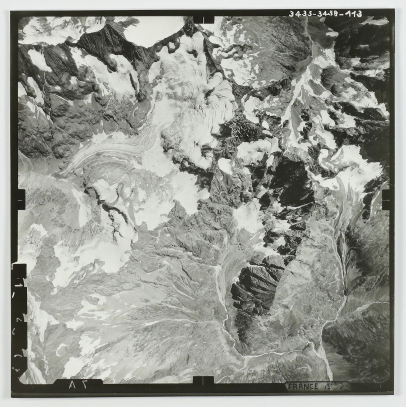
Lagrave-Chorges, 1952.
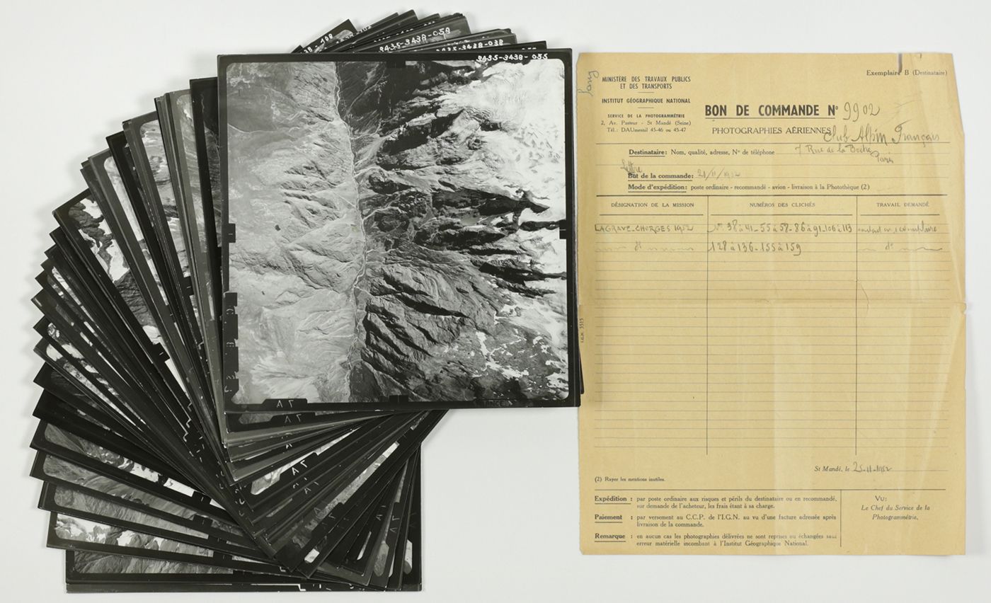
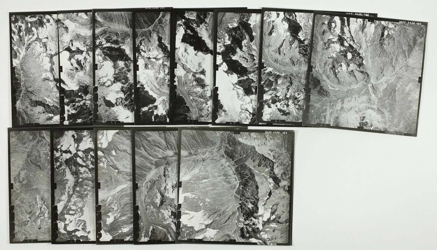
Paris, Institut Géographique National, 1952. 36 original large, square aerial photos (each 19.0 x 19.0 cm). In a matching envelope from the publisher.
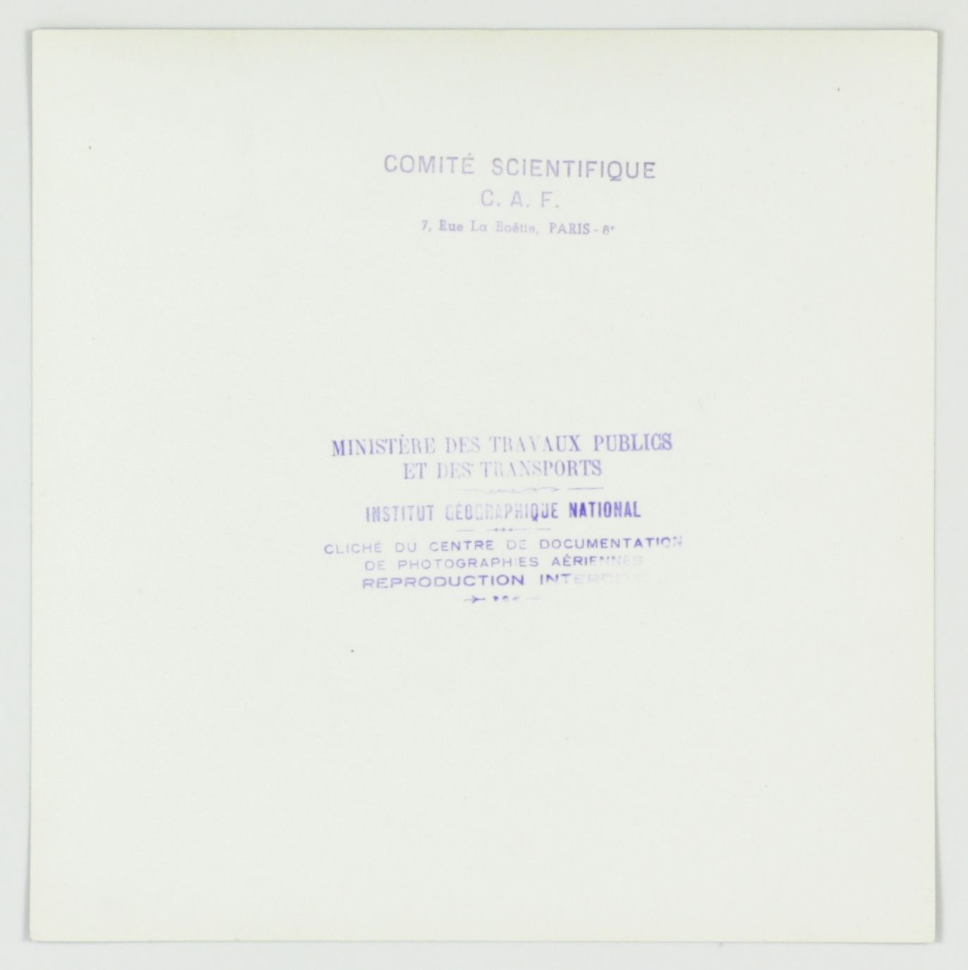
A rare set of photos from the Alpine region in France. The photos were made at the request of the Ministère des Travaux Publics et des Transports, and bear their official stamp on the versos, as well as a stamp of the "Comité Scientifique C.A.F" (Club Alpin Français). A packing list is included, stating the photo numbers (all mentioned are indeed present), and the region covered. This is the area around Lagrave-Chorges, in the French département Haut-Alpes, most probably the Parc national des Écrins, with the highest mountain entirely inside France (Barre des Écrins, 4102 metres). Because of the high resolution, these photos are of interest to climatologists, glaciologists and geologists. Preserved in a publisher's envelope. A very good, unique set.


