![Explication de la carte géologique de la France. Volumes I-IV (text and atlas), and two maps. [Complete].](https://schierenberg.nl/media/cache/product_main/13299/13299.jpg)
Dufrenoy, [O. P. A.] and [J. B. A. L. L.] Élie de Beaumont
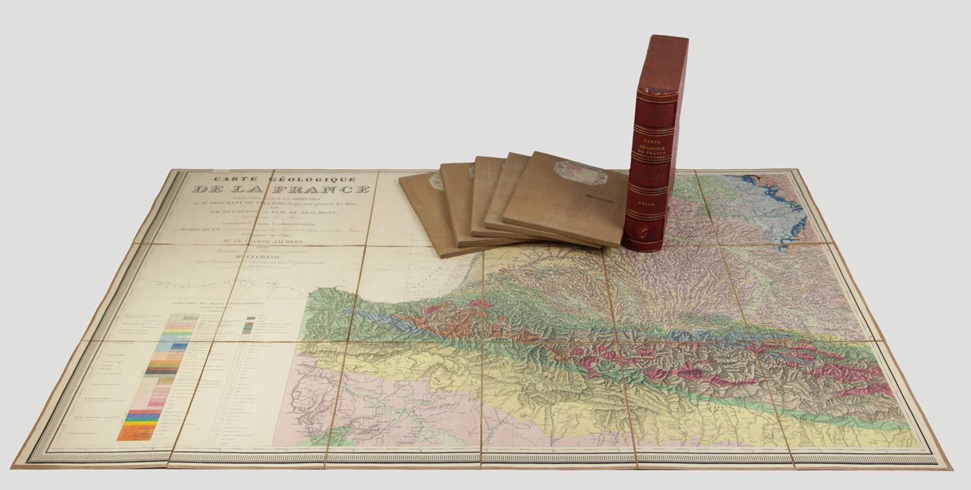
Explication de la carte géologique de la France. Volumes I-IV (text and atlas), and two maps. [Complete].
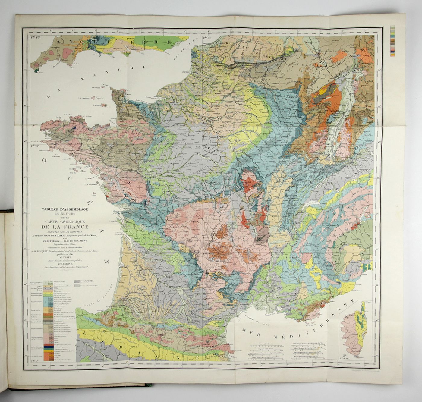
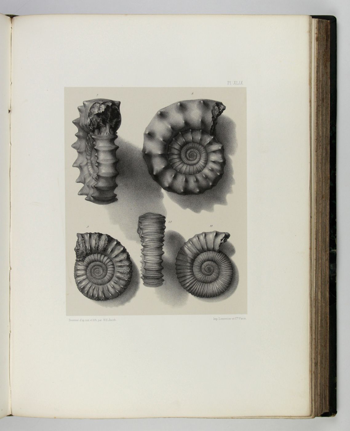
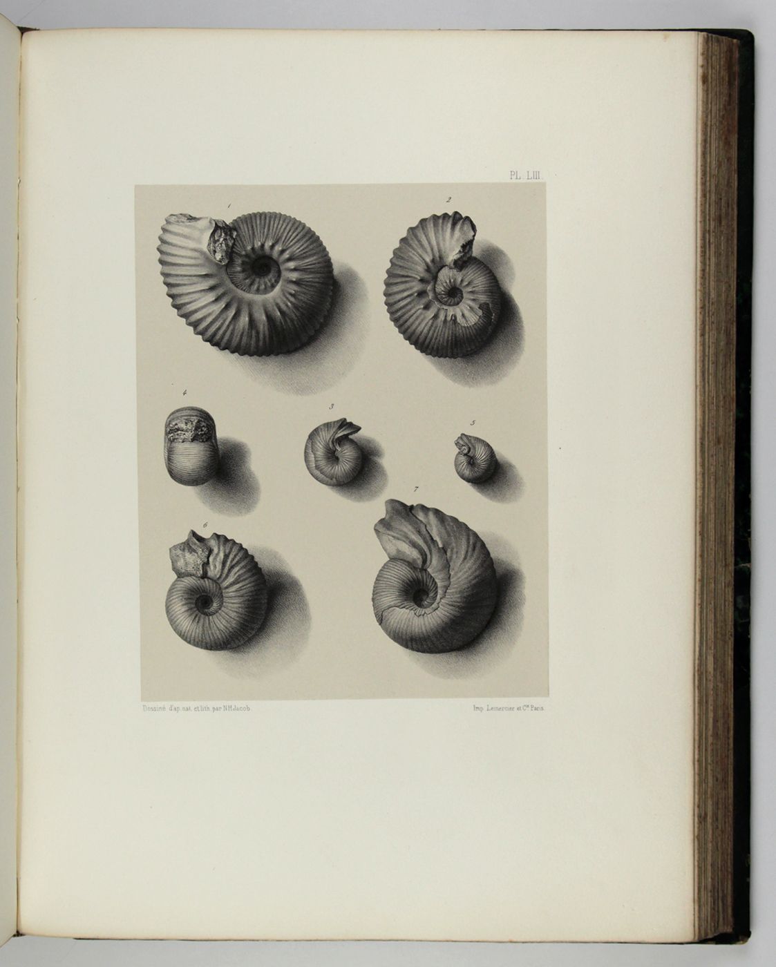
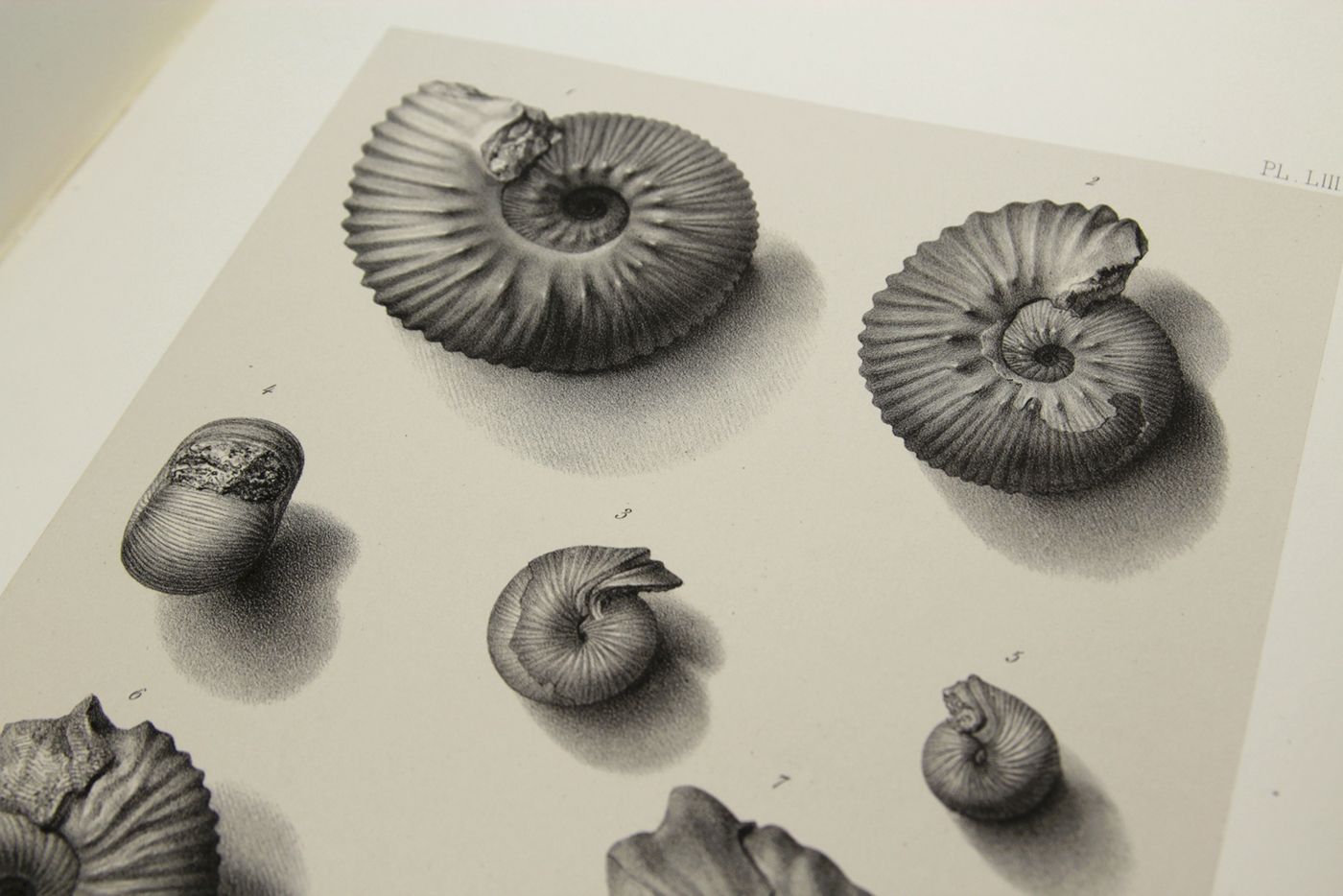
Paris, Imprimerie Royale, Imprimerie Nationale, 1841-1879. Four volumes in seven, and a large map in six folded sheets, each ca. 70 x 205 cm (including borders) with linen covers. Large 4to (four text volumes; ca. 27.5 x 21.0 cm); folio (two atlas volumes, 26.8 x 35.7 cm). Tome premier: Paris, Imprimerie Royale, 1841. Large 4to. xxii, 825 pp., 71 text engravings (mainly profiles); Tome deuxième: Paris, Imprimerie Nationale, 1848. Large 4to. xii, 813 pp., 105 text engravings (mainly views and profiles), one large, folded chromolithographed geological map (finished by hand) of France (printed surface: 57 x 54 cm, and consisting of 15 smaller sections, mounted on linen and folded) bound in the rear; Tome troisième. Première partie (by Dufrénoy): Paris, Imprimerie Nationale, 1873. Large 4to. viii, 231 pp., 18 text engravings (mainly profiles). Printed wrappers. Tome quatrième. Seconde partie. Végétaux fossiles du terrain houiller (by Zeiller): Paris, Imprimerie Nationale, 1879. Large 4to. 185 pp. Printed wrappers; Tome quatrième. Atlas (in two volumes). Première partie. Fossiles principaux des terrains (by É. Bayle). Seconde partie. Végétaux fossiles du terrain houiller (by Zeiller): Paris, Imprimerie Nationale, 1878. Folio. Title page, half title to first part. 86 lithographed plates with explanatory text leaves, numbered I-LXXXVI; 90 lithographed plates with explanatory text leaves, numbered LXXXVII-CLXXVI (the last 16 on plants), for a total of 176 plates. Volumes I, II, and IV plate volumes in near uniform contemporary dark-green pebbled morocco over marbled boards. Spines with five gilt-stippled bands, and gilt title. Marbled endpapers. The text volumes with top edge gilt, atlases with marbled top edges. Text volumes III and IV in original printed wrappers. The large chromolithographed map in six sheets (approximately 218 x 223 cm) is contained in a contemporary, book-like crimson box with gilt-lettered spine, with raised bands and patterned paper sides.
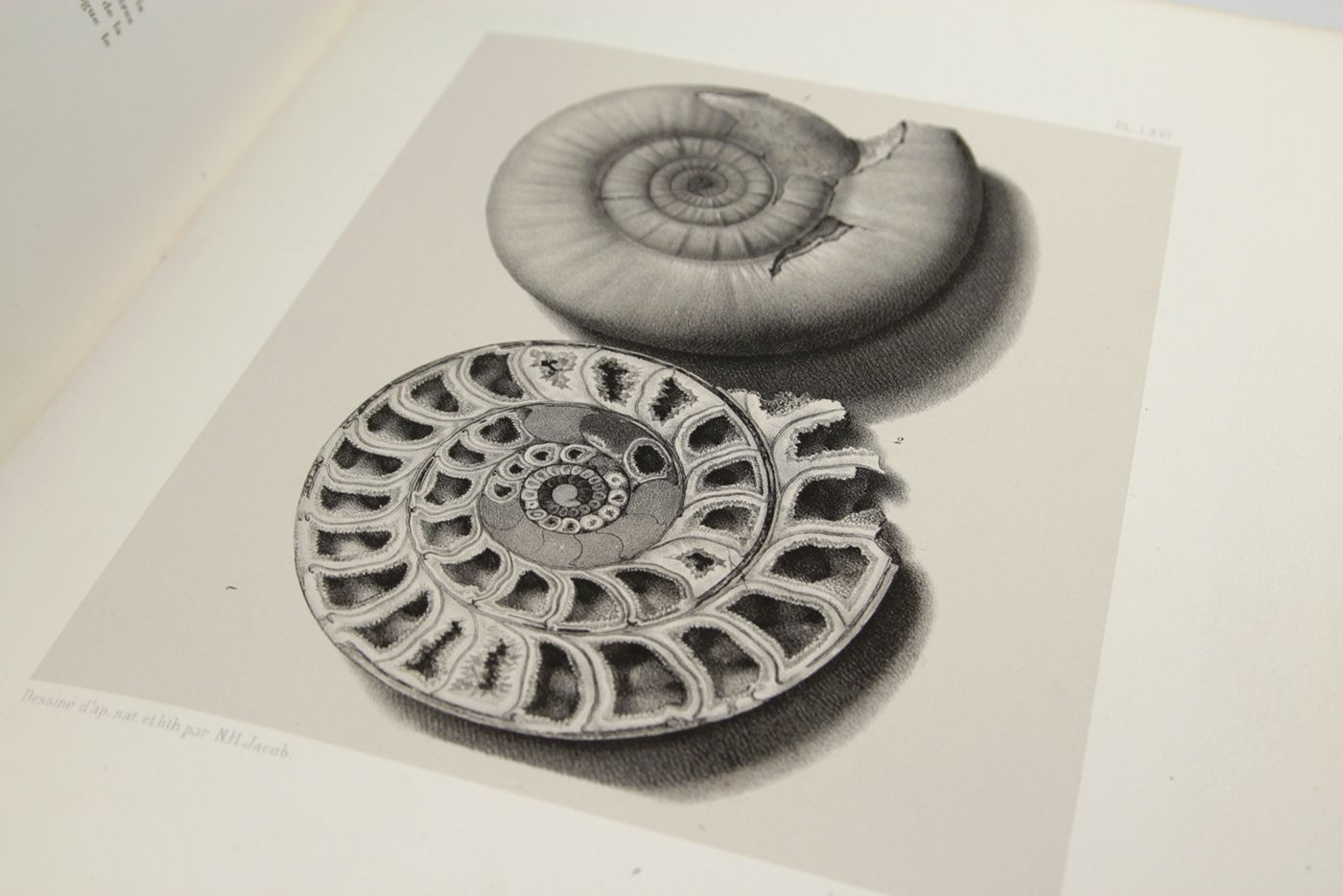
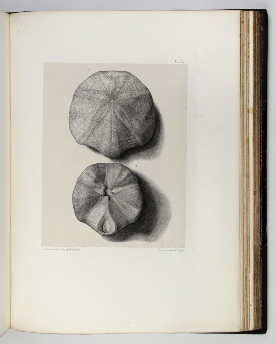
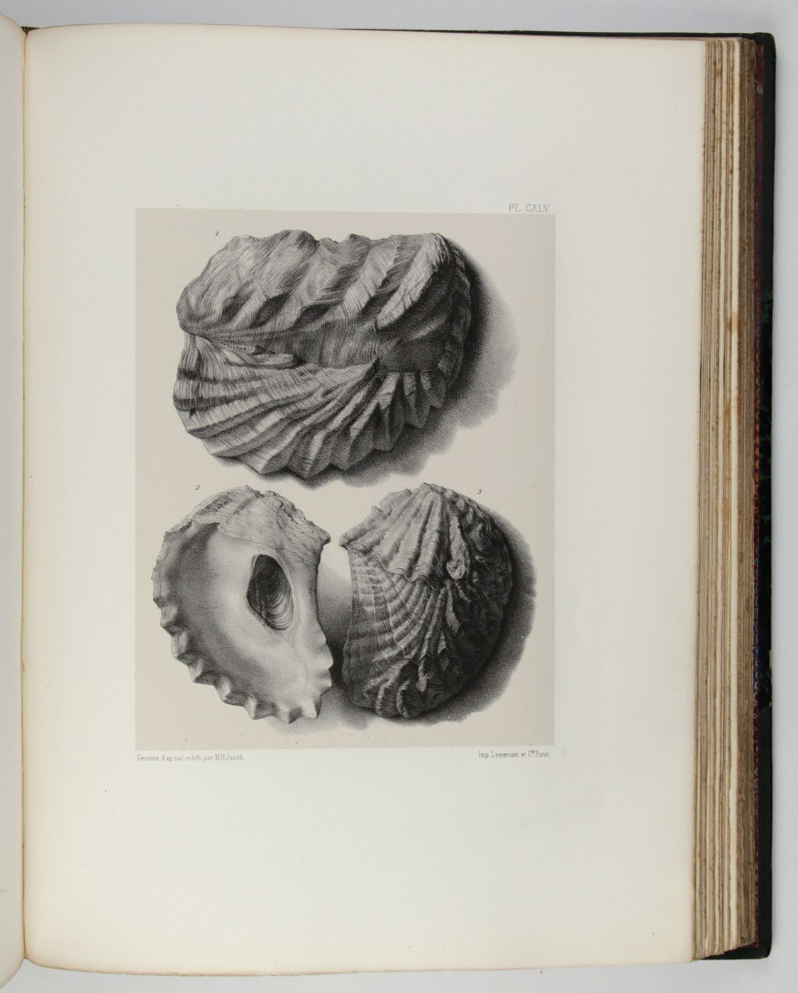
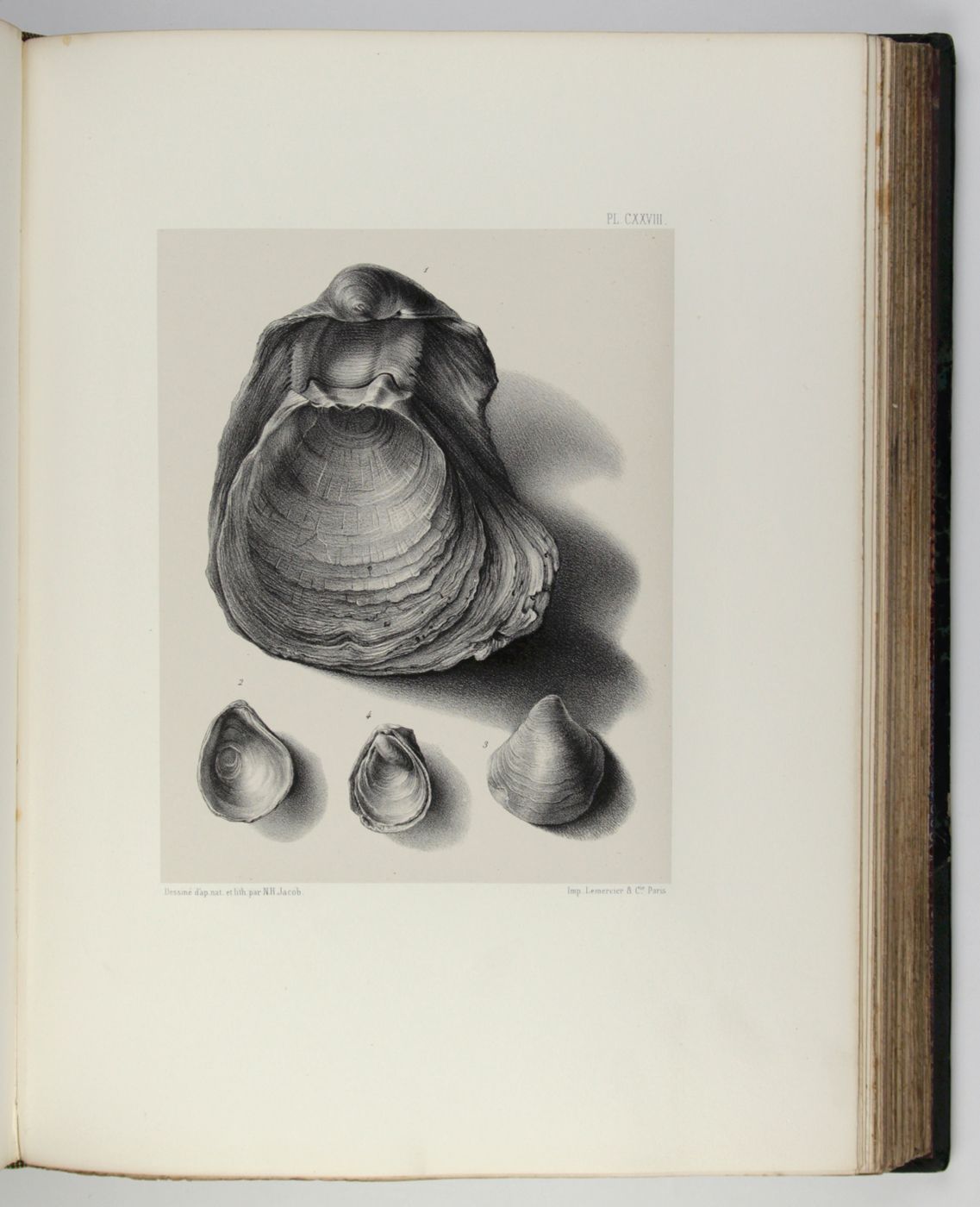
This very important French geological and paleontological work is based upon and includes the first complete geological map of France (and the southern part of the U.K. and Corsica) with a scale of 1:500.000, mounted on linen. The often lacking volumes III and IV, with their atlases are also included, as is the chromolithographed Tableau d'assemblage (57 x 54 cm, bound in text volume 2) which forms the key to the first geological map of France. This map comes in six parts that, when assembled, measures more than two by two meters! Zittel: "Elie de Beaumont and Dufrenoy set to work in 1825 to prepare a geological map of France. At first they worked under the direction of Brochant de Villiers, afterwards they continued independently and in 18 years the text and maps were completed. Its publication exerted a powerful influence on the whole development of geology in France and secured for the two authors a distinguished place...". Volume III is by Dufrenoy alone; the zoological atlas is by Bayle, and includes plates dealing with molluscs (mainly secondary - Mesozoic - ammonites and bivalves; some belemnites and gastropods, as well as several brachiopods and echinoderms); the botanical volume IV (seconde partie) is by Zeiller, with plates (bound in the rear of the second atlas) depicting fossil plants, principally from Carboniferous deposits. The Bayle and Zeiller Atlases are often lacking and thus very rare. A Tome 3, deuxième partie was never published. Some regard Bayle' s atlas as part 2, but there is no indication of this in this work. Also, the Tome 4, première partie remained unpublished, but similarly, Tome 4' s atlas is sometimes regarded as such. In any event, this set contains all that was published. Wrappers to text volumes partly detached and chipped at the edges. All bound volumes with very wide margins, those in wrappers uncut. Both atlas volumes in exceptionally good condition; clean and fresh, almost completely without spotting. The six large map parts with an old stamp on the linen covers, one stamp in one map corner, one map part with a small smudge, but otherwise clean. The attractive, very large map is very rare nowadays. In all, an excellent, complete set. Cat. BM(NH) 2, p. 608 (under France-service); Ward and Carozzi, 697-698, 859-860, 2377; Zittel, 299.

![image for Explication de la carte géologique de la France. Volumes I-IV (text and atlas), and two maps. [Complete].](https://schierenberg.nl/media/cache/product_thumb/13299/13299.jpg)
![image for Rose André Leroy (d'Angers) [from La Belgique horticole. Journal des serres et des vergers].](https://schierenberg.nl/media/cache/product_thumb/70918/70918_x.jpg)

