
Mountains
45 items found
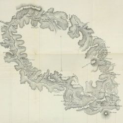
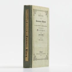
Forbes, J. D.
Reisen in den Savoyer Alpen und in anderen Theilen der Penninen-Kette, nebst Beobachtungen über die Gletscher.
Stuttgart, Schweizerbart, 1845. 8vo (21.0 x 13.3 cm). xii, 386 pp.; seven lithographed plates (of which one hand-coloured) and two folded lithographed maps depicting the Chamonix Alps. Early 20th-century cloth with mounted title and backstrip from original printed boards and spine.
Read more
Fuchs, W.
Die Venetianer Alpen. Ein Beitrag zur Kenntniss der Hochgebirgte, met einen geognostischen Karte und Gebirgteprofilen in achtzehn Tafeln.
Solothurn, Jent & Gassmann, 1844. Oblong folio (29.8 x 35.5 cm), [4], 60 pp.; 18 mostly hand-coloured engraved maps and plates. Text pages bordered with putti and goddesses. 19th century iridescent blue blind cloth.
Read more
Hedin, S. and F. Bergman
History of the Expedition in Asia 1927-1935. Part II. Reports from the Scientific Expedition to the North Western Provinces of China Under the Leadership of Dr Sven Hedin. The Sino-Swedish Expedition, Publication 24.
Stockholm, Elander, 1943. 4to (28.3 x 22.7 cm). xv, 215 pp.; 60 photographic plates. Contemporary full beige cloth with gilt leather labels on spine. Original buff, printed wrappers bound in.
Read more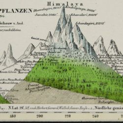
Humboldt F. [H.] A. von [Freiherr]
Kosmos. Entwurf einer physischen Weltbeschreibung. [Complete set of five text volumes and the authorized atlas by Bromme].
Stuttgart and Tübingen, J. C. Cotta, 1845-1862. Six volumes (text and atlas) in seven. 8vo (21.0 x 13.1 cm). 3546 pp. (1 [1845]: xvi, 394; 2 [1847]: 544; 3 [1850] 645; 4 [1858] 650; 5.1-5.2 [1862] 1-592; 593-1297). Atlas in two parts (descriptive text; maps) oblong 4to (28.1 x 34.1 cm); two title pages, [ii], 136 pp. (for a total of 3674 pp.); 42 lithographed and engraved maps of which 39 originally hand-coloured. Text volumes: Uniform brown, grained half morocco over pebbled boards. Spines with gilt ornamental bands and vignettes. Yellow endpapers. Mottled edges. Atlas volumes: uniform brown full cloth. Spines with gilt ornamental bands and title. Original printed wrapper bound in.
Read more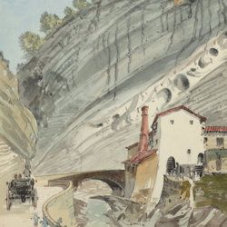
["JAM" (R. de Bouillé, Comte)]
[Original watercolour sketches of French landscapes]
[France], no place, no publisher, ca. 1863-1890. 13 oblong sheets (22.3 x 29.2 cm), all with fine watercolour paintings, either full-sized, or smaller, in a drawn rectangular frame. And one drawing on slightly smaller paper, more sketchy, in pencil.
Read more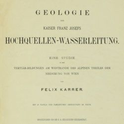
Karrer, F.
Geologie der Kaiser Franz Josefs Hochquellen-Wasserleitung. Eine Studie in den Tertiär-Bildungen am Westrande des alpinen Theiles der Niederung von Wien.
Wien, Hölder, 1877. Large 4to (33.5 x 25.5 cm). xiii, 420 pp.; 96 text engravings, 20 folded profiles, maps and lithographed plates, mostly coloured and several very large (size up to 32 x 100 cm), seven folded charts and tables. Later half cloth with paper label on the spine.
Read more
Lecoq, H.
[Auvergne] Itinéraire de Clermont au Puy de Dome, ou description de cette montagne et de la Vallée de Royat et Fontanat; seconde edition. [AND] Two other papers on the geology of Auvergne, by A. C. P. F. Von Lasaulx, and by J. B. Bouillet, bound in.
Paris, J. B. Baillière, 1836. 8vo (21.2 x 13.3 cm). vi, 102 pp. Early 20th century half morocco over marbled boards. Spine with five raised bands and gilt title. Marbled endpapers.
Read more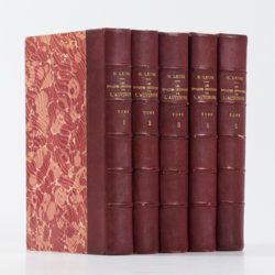
Lecoq, H.
Les époques géologiques de l'Auvergne. Avec 170 planches ou figures, dont plusieurs coloriées et des autographes de Dolomieu, d'Hauy & de De Saussure et un dessin fac simile de Madame Necker de Saussure. I-V. [Complete].
Paris, Baillière et fils, 1867. Five volumes in five. Large 8vo (23.7 x 15.2 cm). 2,758 pp.; 180 engraved and lithographed (tinted, or chromolithographed) plates [1-141, 143-169, 41(bis), 57(bis), 89bis, 107(bis), 149bis, 152bis, 163bis, 163ter, 165bis, 165ter, 165quater, 165quinter], on 107 sheets (several double-sized). Uniform burgundy half morocco over marbled boards. Spines with five raised bands, gilt title. Marbled endpapers. Speckled edges.
Read more
