Exploration - Expeditions
49 items found
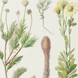
Dusén, P. et al. [W. B. Scott (ed.)]
Reports of the Princeton University Expeditions to Patagonia 1896-1899. Volume VIII, 1-2. Botany. I-IX. [Complete].
Princeton, NJ, Princeton University, [AND] Stuttgart, Schweizerbart (E. Nägele), 1903-1906. Nine parts (two volumes) in three. Large 4to (32.1 x 25.1 cm). 982 pp.; 106 text figures, 31 lithographed plates, of which several in chromolithography. Uniform early 20th-century pebbled black half cloth over green linen boards. Gilt title on the spines.
Read more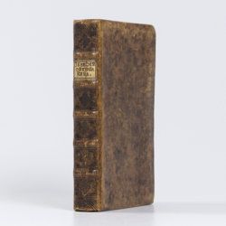
Osbeck, P.
Dagbok öfver en Ostindisk Resa, Åren 1750. 1751. 1752. Med anmärkringar uti Naturkunnigheten, främmande Folkslags Sprak, Seder, Hushallning, m.m.
Stockholm, L. L. Grefing, 1757. 8vo (11.8 x 19.6 cm). [vi], 376, [xvi] pp.; 12 engraved plates. Near contemporary full mottled calf. Spine with five raised bands, blind-tooled floral patterns and vellum label with title. Speckled edges.
Read more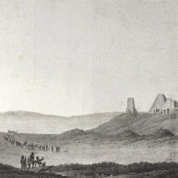
Rüppell, E.
Reisen in Nubien, Kordofan und dem petraeischen Arabien vorzueglich in geographisch-statisticher Hinsicht.
Frankfurt [am Main], Friedrich Wilmans, 1829. Large 8vo (23.0 x 13.1 cm). xxvi, 388 pp.; eight folded engravings and five maps on four folded sheets (combined numbering is 1-12, with two maps on plate 10). In an expertly made period-style speckled half calf binding. Marbled boards. Spine with gilt chains and vignettes, and red morocco label with gilt title.
Read more
Bourrit, M. T.
Description des Alpes, Pennines et Rhetiennes; dédiée a.s.m. très-chrétienne Louis XVI, roi de France et de Navarre. Tome premier - second. [Complete].
Genève, J. P. Bonnant, 1781. In two volumes. 8vo (21.5 x 13.8 cm). xix, 247 pp.; [ii], 285 pp.; eight engraved plates, mainly of glaciers, and one folded engraved map of the Alps, several wood engraved vignettes in the text. Original uniform blind publishers' wrappers. Spines renewed with later printed labels. Contained in a later blue cloth slipcase (23.2 x 15.8 x 6.9 cm) with black morocco label with gilt title.
Read more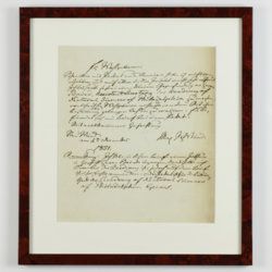
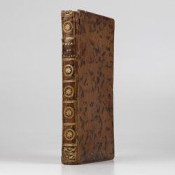
Hamilton, W.
Voyage à la cote septentrionale du Comté d'Antrim en Irlande, et à l'ile de Raghery, contenant l'histoire naturelle de ses productions volcaniques & plusieurs observations sur les antiquités & moeurs de ce pays... auquel on a ajouté l'essai sur l'oryctographie du Derbyshire par M. Ferber, traduit de l'Allemand.
Paris, Cuchet, 1790. 8vo (19.6 x 12.5 cm). viii, 239 pp.; engraved folding plate showing several geological layers of Derbyshire. Contemporary full mottled calf. Spine rich gilt with floral vignettes, small red morocco label with gilt title. Marbled endpapers, red edges.
Read more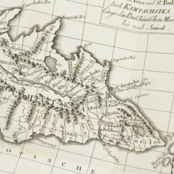
Lesseps, [J. B. B.] de
Herrn von Lesseps Gefährten des Grafen de la Perouse Reise durch Kamtschatka und Sibirien nach Frankreich. Aus dem Französischen übersetzt. Mit Anmerkungen von Johann Reinhold Forster.
Berlin, Voss, 1791. 8vo (22.4 x 14.5 cm). xxviii, 302 [303-544] pp.; two engraved, folded maps, one folded table. Original blind boards.
Read more
Ogilvie-Grant, W. R. (ed.). a. o.
Reports of the collection made by the British Ornithologists' Expedition and the Wollaston Expedition in Dutch New Guinea, 1910-1913.
London, Francis Edwards, 1916. In two volumes. Large 4to (33.2 x 25.6 cm). Text; 41 plates of which 13 in chromolithography; 76 text figures; two fine, coloured, double-sized maps. Original uniform printed wrappers.
Read more
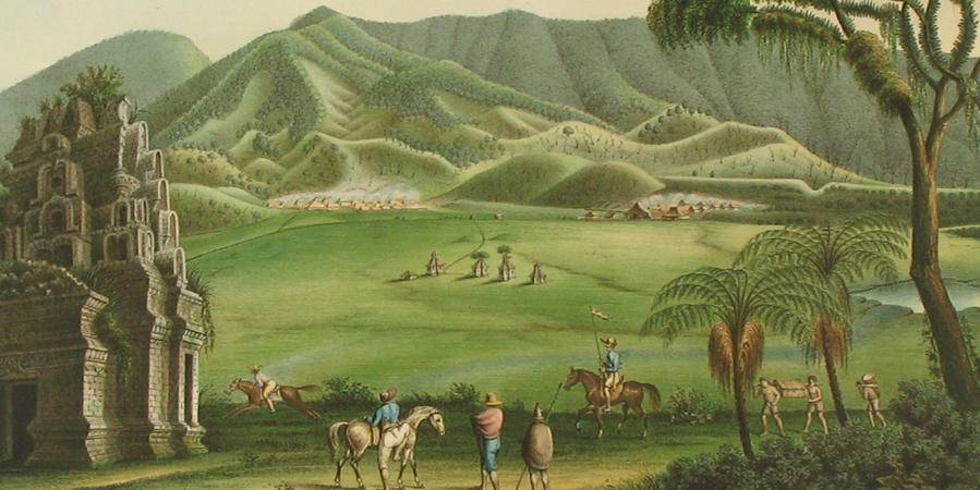
[Prévost d'Exiles, A. F.]
Histoire générale des voyages, ou nouvelle collection des toutes les relations de voyages par mer et par terre, qui ont été publiées jusq'à présent dans les différentes langues de toutes les nations connus: ... Tome dix-septième. Histoire générale des voyages, depuis le commencement du XVme siècle, dix-septième partie. Livre septième. Vies des gouverneurs généraux, avec l'abregé de l'histoire des etablissemens Hollandois aux Indes Orientales [AND] Histoire naturelle des Indes Orientales.
La Haye [Den Haag, The Hague], Pierre de Hondt, 1763. 4to (25.1 x 20.4 cm). [ii], 266, 300, 48 pp.; 56 plates (of fish, etc.). Contemporary half calf over speckled boards. Spine with five raised bands. Gilt title.
Read more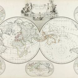
Malte-Brun, [C.]
Précis de la géographie universelle, ou description de toutes les partes du monde, sur un plan nouveau d'après les grandes divisions naturelles du globe. Précédée de l'histoire de la géographie chez les peuples anciens et modernes, et d'une théorie générale de la géographie mathématique, physique et politique. Collection de cartes géographiques. [AND] Atlas supplémentaire du Précis de la géographie universelle de M. Malte-Brun; dressé conformément au texte de cet ouvrage et sous les yeax de l'auteur, par M. Lapie, capitaine ingénieur géographie. [Atlases].
Paris, François Buisson, 1810-1812. Two parts in one. Folio (34.0 x 25.8 cm). Title pages, 14 pp. [ii; 12]; 75 [24; 51] engraved and hand-coloured maps. 19th-century black quarter calf over black pebbled boards. Spine with four slightly raised, gilt-lined bands; compartments with triple-gilt borders and title. Marbled endpapers. All edges gilt.
Read more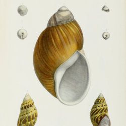
Hidalgo, J. G. et al.
Moluscos del viaje al Pacífico verificado de 1862 a 1865 por una comision de naturalistas enviada por el gobernierno español. Parta primera. Univalvos terrestres. Parte segunda. Bivalvos marinos. Parte tercera. Univalvos marinos. [AND] Náyades del Viaje al Pacífico verificado de 1862 a 1865 por una comision de naturalistas enviada por el gobernierno español. [All Published].
Madrid, Museo Nacional de Ciencias Naturales, [1869]-1870-1916. Four parts in one. 4to (30.0 x 22.0 cm) and 8vo (23.1 x 16.1 cm). 441 pp. ([vi], 5-152; 80; 144; 63); 17 plates (8; [7]; 0; 2) of which the first seven originally hand-coloured, and the last two with printed overlays. Mid-20th century burgundy buckram with gilt lines and title on the spine. Original printed wrappers bound in.
Read more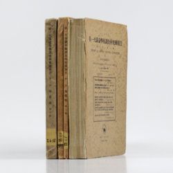
Tokunaga, S. et al.
Report of the First Scientific Expedition to Manchoukuo. Under the leadership of Shigeyasu Tokunaka. June - October 1933. Section II [Geology]. Part I-IV. [Complete].
Tokyo, Asahi, 1934-1939. Four volumes in four. 4to (26.0 x 19.0 cm). Ca. 700 pp. with 124 plates and three folding coloured maps. Original uniform printed stiff wrappers.
Read more
