Exploration - Expeditions
49 items found
Conway, W. M.
Ascensions et explorations a sept mille mètres dans l'Himalaya.
Paris, Hachette, 1898. 8vo (17.9 x 11.4 cm). Title page with pictorial vignette, v, 242 pp.; frontispiece and 47 illustrations, mostly after photographs, and a map. Later black cloth with gilt title on the spine. Original pictorial front wrapper bound in.
Read more
Hedin, S. and F. Bergman
History of the Expedition in Asia 1927-1935. Part II. Reports from the Scientific Expedition to the North Western Provinces of China Under the Leadership of Dr Sven Hedin. The Sino-Swedish Expedition, Publication 24.
Stockholm, Elander, 1943. 4to (28.3 x 22.7 cm). xv, 215 pp.; 60 photographic plates. Contemporary full beige cloth with gilt leather labels on spine. Original buff, printed wrappers bound in.
Read more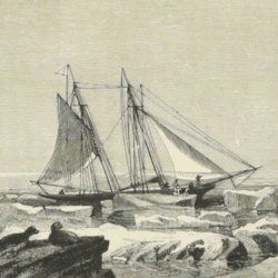
Hamilton-Temple-Blackwood, F. T. [Lord Dufferin]
A yacht voyage. Letters from high latitudes; being some account of a voyage, in 1856, in the schooner yacht "Foam" to Iceland, Jan Mayen, and Spitzbergen, by Lord Dufferin, Governor General of the Dominion of Canada.
Toronto, Adam, Stevensen, 1873. 8vo (18.1 x 12.0 cm). 281 pp., engraved frontispiece, tissue-guarded portrait of the author, nine engraved plates including one of a skeleton in a coffin captioned: "Et ego in arctis", several wood engravings in the text. Original decorated cloth with bevelled edges and gilt title on the spine, and gilt title and large vignette on the front board.
Read more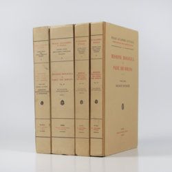
Zavattari, E (ed.)
Missione Biologica nel Paese dei Borana. [Complete in four volumes].
Roma, Centro Studi Africa Orientale, 1939-1940. In four volumes. Large 8vo (24.9 x 17.6 cm). 2,154 pp. [537, 719, 463, 435]; over 500 text illustrations; 23 [0; 16; 7; 0] plates, mostly coloured, one coloured map and one large, folded map. Uniform original quarter cloth over printed boards. Spines with large, printed labels.
Read more
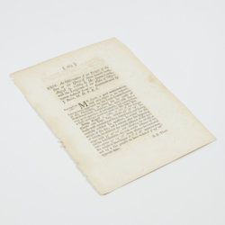
Cook, J.
An observation of an eclipse of the sun at the island of New-found-land, August 5, 1766, by Mr. James Cook, with the longitude of the place of observation deduced from it: communicated by J. Bevis, M. D. F. R. S.
London, The Royal Society, 1767. 4to (22.3 x 17.0 cm). 2 pp. Disbound.
Read more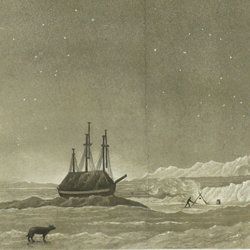
Parry, W. E.
Reis ter ontdekking van eene noordwestelijke doorvaart uit de Atlantische in de Stille Zee, gedaan in de jaaren 1819 en 1820 door de schepen The Hecla en The Griper onder bevel van W. E. Parry. Uit het Engelsch. Met kaarten en platen.
Amsterdam, Johannes Van der Hey, 1822. 8vo (20.8 x 12.1 cm). xii, 333 pp.; two large, folded engraved plates, two engraved folded maps. Contemporary half calf over marbled boards. Spine with gilt ornamental bands and red morocco label with gilt title.
Read more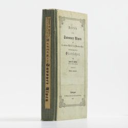
Forbes, J. D.
Reisen in den Savoyer Alpen und in anderen Theilen der Penninen-Kette, nebst Beobachtungen über die Gletscher.
Stuttgart, Schweizerbart, 1845. 8vo (21.0 x 13.3 cm). xii, 386 pp.; seven lithographed plates (of which one hand-coloured) and two folded lithographed maps depicting the Chamonix Alps. Early 20th-century cloth with mounted title and backstrip from original printed boards and spine.
Read more
various authors
[Alert voyage] Report on the zoological collections made in the Indo-Pacific Ocean during the voyage of the HMS Alert 1881-1882.
London, Taylor and Francis, 1884. 8vo (22.4 x 14.1 cm). xxv, 684 pp.; 54 lithographed plates (some partially coloured). Original embossed and gilt-lettered cloth.
Read more
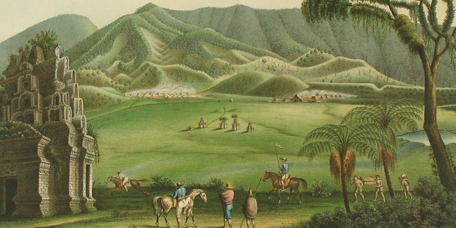
Doria, G. and R. Gestro (eds.)
Esplorazione del Giuba e dei suoi affluenti compiuta dal cap. V. Bottego durante gli anni 1892-93 sotto gli auspicii del Società Geografica Italiana. - Resultati zoologici.
Genova, Museo Civico di Storia Naturale di Genova, 1895. 8vo (25.5 x 17.0 cm). xviii, 558 pp.; five lithographed plates; one very large, folded map of the Horn of Africa. Original printed wrappers.
Read more
Spencer, [W.] B. (ed.)
Report on the work of the Horn Scientific Expedition to Central Australia. Part I. Introduction, narrative, summary of results, supplement to zoological report, map.
London, Dulau; Melbourne, Mullen and Slade, 1896. 4to (25.6 x 19.2cm). xviii, 220 pp.; 11 plates, seven text illustrations, one large, multi-folded map. Original azure buckram with gilt title on the spine.
Read more
