
Geography
42 items found
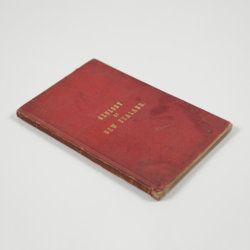
Hochstetter, F. von and A. Petermann.
The geology of New Zealand: in explanation of the geographical and topographical atlas of New Zealand by Dr. F. Von Hochstetter and Dr. A. Petermann, from the Scientific Publications of the Novara Expedition. Translated by C. F. Fischer. Also, lectures by Dr. F. Hochstetter delivered in New Zealand.
Auckland, T. Delattre, 1864. 8vo (21.0 x 13.6 cm). Title page, 113 pp. Original grained red cloth with gilt title on the front board.
Read more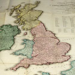
Enouy, J.
The United Kingdom of Great Britain & Ireland, with the adjacent parts of the Continent, from Amsterdam to Paris and Brest, compiled from a variety of the most authentic materials.
London, Samuel Leigh, 1818. Large, folded, coloured map (62.7 x 75.3 cm) of Great Britain and Ireland, and the continental coasts of the Channel and North Sea. In original reddish paper-covered boards, with printed label mounted.
Read more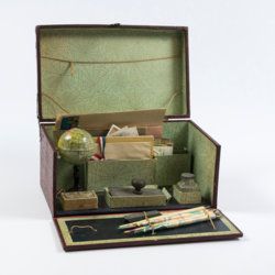
Travelling writer's kit
Travelling writer's kit with stationery and miniature globe.
Paris, ca. 1915-1925. Portable red cardboard box (28.0 x 16.9 x 14.3 cm) embossed with maroon reptile-skin patterned paper with gilt title "Papeterie" and vignette, and simple brass lock. Inside covered with decorative green-with-black-cobweb patterned paper.
Read more
Unger, F.
Ueber den Einfluss des Bodens auf die Vertheilung der Gewächse nachgewissen in der Vegetation des nordöstlichen Tirols.
Wien, Rohrmann und Schweigerd, 1836. 8vo (21.4 x 13.5 cm). xxiv, 367 pp.; one hand-coloured engraved plate of Kitzbühl, one large, folded, hand-coloured geological-geographical map, one large, folded hand-coloured sheet with geological profile, five folded charts with meteorological observations (four) and botanical observations (one), many tables in the text. Contemporary quarter calf over marbled boards. Spine with gilt lines, vignettes, and title. Marbled endpapers; speckled edges.
Read more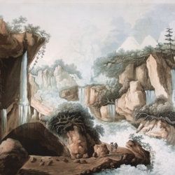
Belanger, L. and P. Vanlerberghe and S. Malgo
View of the torrent of the Lutschinen, and of the glaciers where it takes its source – Vue du torrent de la Lutschinen en Suisse, et des glaciers ou il prend sa source.
London, G. & W. Nicoll, 1800. Broadsheet (71.0 x 56.0 cm). Aquatint, finished by hand.
Read more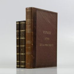
Saulcy, [L.] F. [J. C.] de
Voyage autour de la Mer Morte et dans les terres bibliques exécuté de décembre 1850 à avril 1851. Relation de voyage; atlas. [Complete].
Paris, Gide et J. Baudry, 1852-1853. In two text volumes and one atlas volume. 8vo (24.5 x 16.0 cm [text]). 1054 pp. [399; 655]). Folio/large 4to (31.0 x 23.7 cm [atlas]). 172 pp. [4, vii, 20, i-iv, 5-19; xxvi, 96]; 15 maps on 14 sheets (one double-sized); 61 (LVII; 4) lithographed plates (several tinted). Text in near contemporary uniform half calf over marbled boards. Spines with gilt bands and title; Atlas in contemporary half morocco over grained, cloth with gilt title on the front board and spine. Marbled endpapers. Original printed wrappers of the text volumes bound in.
Read more
