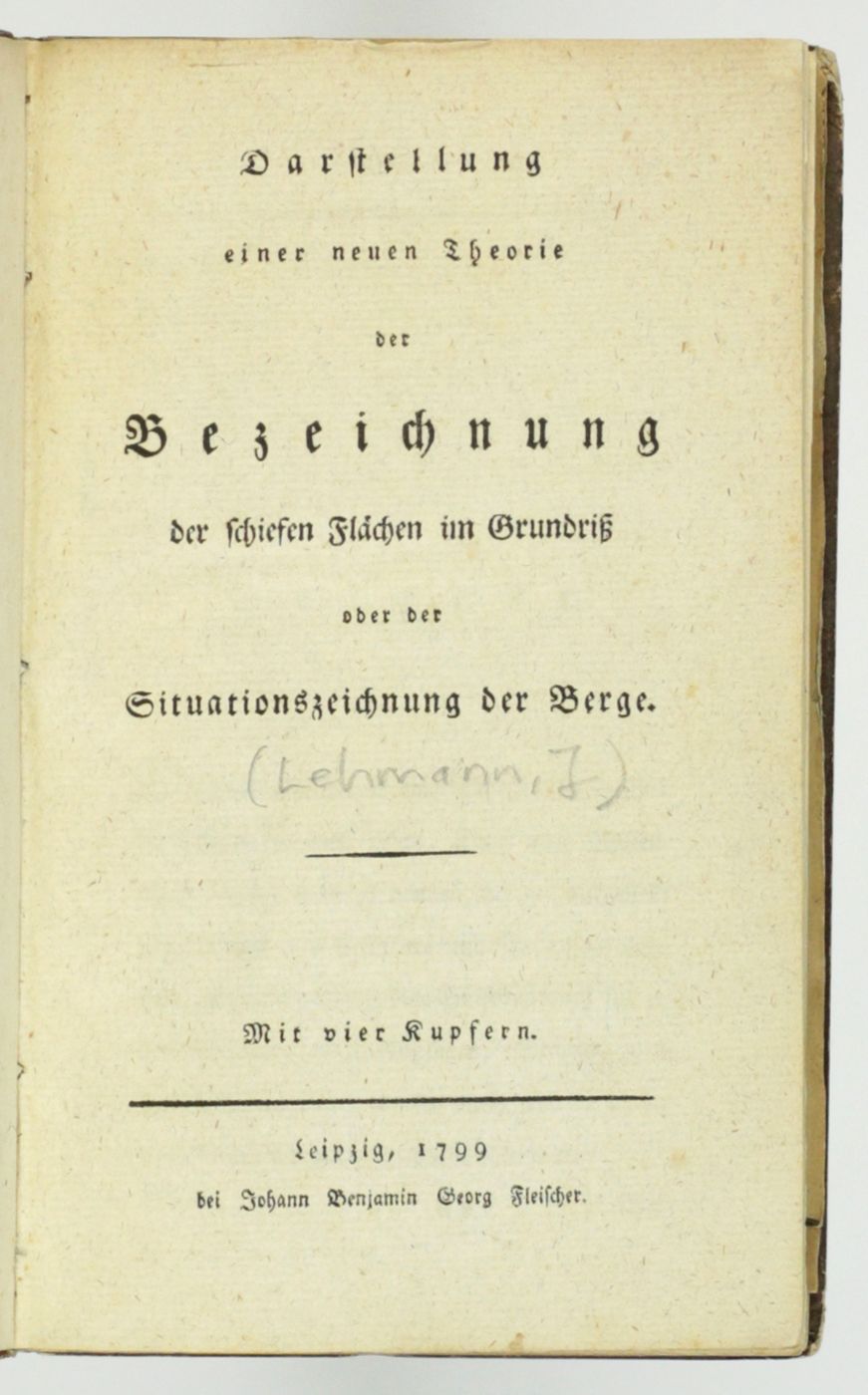
[Lehmann, J. G.]
Darstellung einer neuen Theorie der Bezeichnung der schiefen Flächen im Grundriss oder der Situationszeichnung der Berge.
Leipzig, Johann Benjamin Georg Fleischer, 1799. 8vo (19.6 x 12.0 cm). xx, 172 pp.; four large, folded, engraved plates. Contemporary full tree calf. Spine with morocco label with gilt ornamental lines and title. Edges pale yellow.
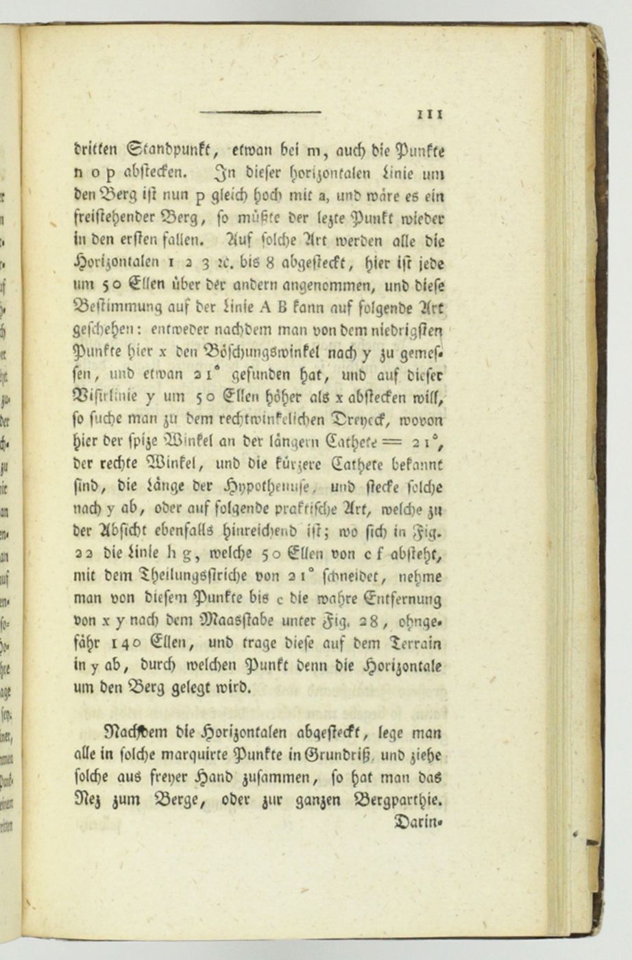
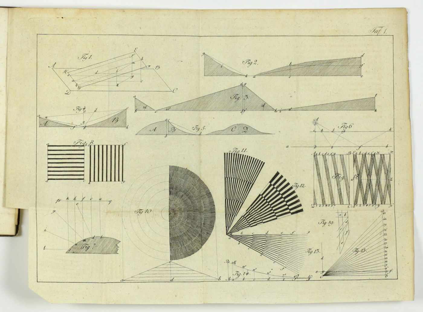
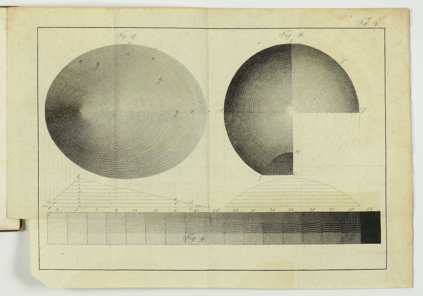
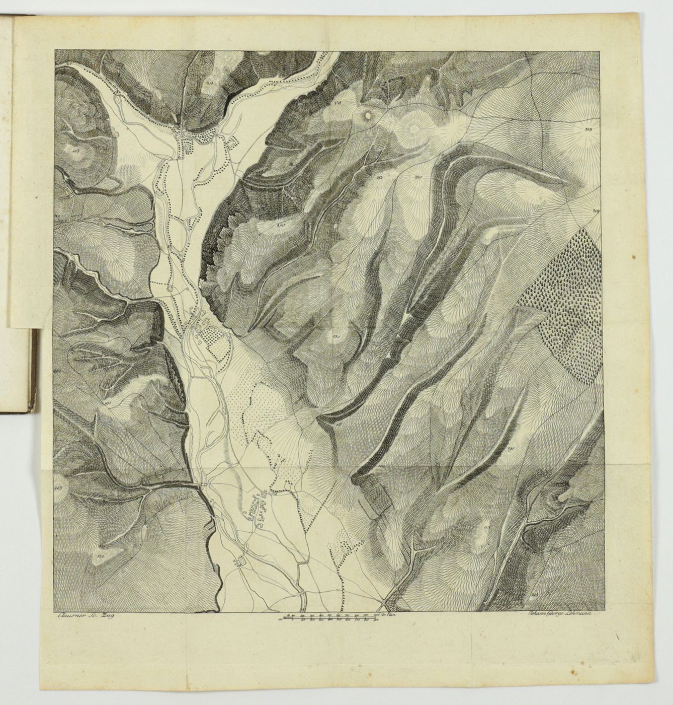
An important work on cartography, geomorphology and trigonometry, with the chief objective of introducing a standard method of visualising optical relief in geographical and geological maps. The author is the German geologist Johann Georg[e] Lehmann (1776-1811). He is neither mentioned on the title page, nor in the preface, but he did sign the last two plates (with his middle name ending in an e). “From 1789 he attended the War School in Dresden. During mapping courses he developed what was to be named Lehmann's hatching: The steeper the terrain, the darker the hachures are shown. This invention, which he published in this work, became the dominant method of relief representation of the topographic maps of the 19th century. Lehmann's goal was to reproduce the relief with only a single, legible method, suitable for military purposes” (after Wikipedia). A fine and clean copy. Not in Ward and Carozzi.


