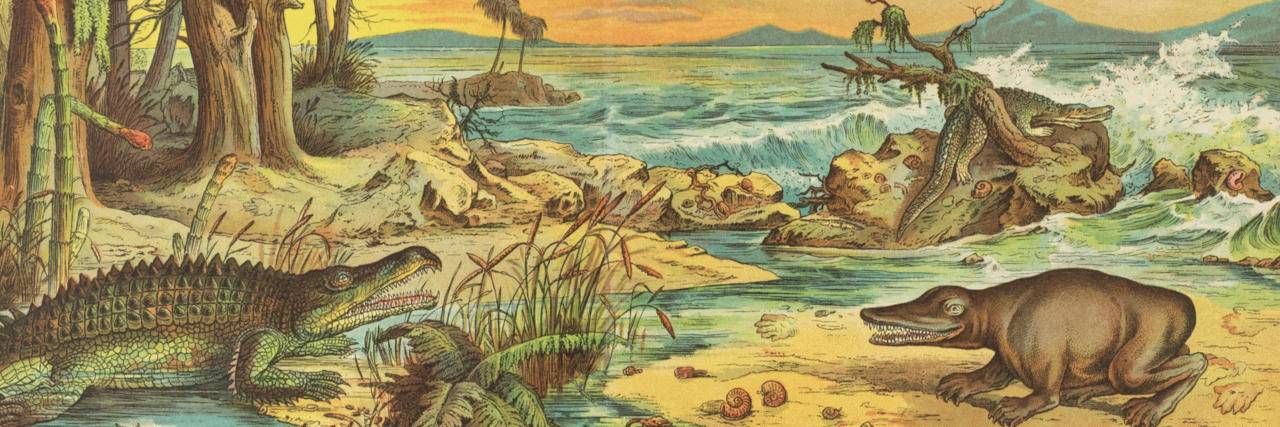
Mesozoic
36 items found
Sauvage, [F.] C. and [N.] A. Buvignier
Statistique minéralogique et géologique du département des Ardennes.
Mézières, Trecourt, 1842. 8vo (21.0 x 13.0 cm). xlv, 554 pp.; five lithographed plates. Contemporary half morocco over marbled boards. Spine with four raised, gilt-stippled bands; compartments with blind-stamped and gilt ornamental borders. Marbled endpapers.
Read more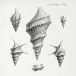
Orbigny, A. [C. V.] D. d'
Paléontologie Française. Description des mollusques et rayonnés fossiles. Terrains Jurassiques. II. Gasteropodes. Texte, Atlas. [Complete].
Paris, Victor Masson, 1850-1860. Two volumes in two. 8vo (21.3 x 13.2 cm [text]; 22.1 x 14.6 cm [atlas]). 623 pp.; 198 lithographed plates, numbered 235-431, 237bis. Contemporary uniform half morocco over marbled boards. Spines with four raised bands, gilt vignettes and title. Marbled endpapers.
Read more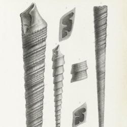
Orbigny, A. [C. V.] D. d'
Paléontologie Française. Description des mollusques et rayonnés fossiles. Terrains Jurassiques. II. Gasteropodes. Texte, Atlas. [Complete].
Paris, Victor Masson, 1850-1860. Two volumes in two. 8vo (22.2 x 14.1 cm [text]; 22.0 x 15.7 cm [atlas]). 623 pp.; 198 lithographed plates, numbered 235-431, 237bis. Contemporary uniform half morocco over marbled boards. Spines with four raised bands, gilt vignettes and title. Marbled endpapers.
Read more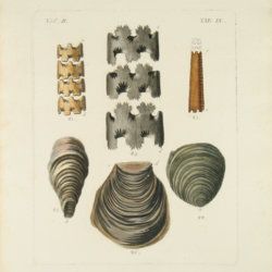
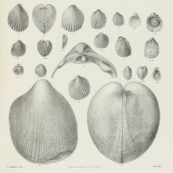
Stoliczka, F.
Palaeontologia Indica, being figures and descriptions of the organic remains procured during the progress of the geological survey of India. Vol. III. The Pelecypoda, with a review of all known genera of this class, fossil and recent.
Calcutta, Geological Survey Office, 1871. Folio (37.0 x 25.1 cm). Title page, xxii, 538 pp.; 50 lithographed plates with explanatory text leaves. Near-contemporary half calf with blind-tooled borders over pebbled boards. Spine with gilt lines, and two red morocco labels with gilt title.
Read more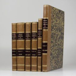
[Various geologists and palaeontologists]
Mémoires de la Société Linnéenne de Normandie. Volumes I-V. [IINCLUDING Société Linnéenne de Calvados].
Caen, Société Linnéenne de Normandie, 1824-1835. Five volumes in six. 8vo (volumes I-IV, 21.0 x 13.2 cm), 4to (volume V, 27.6 x 22.0 cm), and oblong folio (atlas to volumes II-IV, 22.5 x 31.0 cm). Title pages; 15 lithographed (partly folded) plates in volume I, one hand-coloured geological map, 39 lithographed plates in the atlas volume, mainly depicting lichens by Delise, and geological maps (11 hand-coloured). Uniform later half calf over marbled boards. Spines with gilt title.
Read more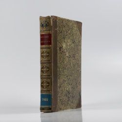
Cuvier, G. [L. C. F. D.] and A. Brongniart
Description géologique des environs de Paris, par MM. G. Cuvier et Alex. Brongniart. Nouvelle édition, dans laquelle on a inséré la descrition d'un grand nombre de lieux de l'Allemagne, de la Suisse, de l'Italie, etc., qui présentent des terrains analogues a ceux du Bassin de Paris. Avec 2 cartes et 16 planches représentant les coupes de ces terrains et beaucoup des coquilles fossiles qu'ils renferment, et une table alphabétique de tous les lieux décrits ou seulement cités.
Paris, G. Dufour et E. d'Ocagne, 1822. 4to (29.3 x 22.2 cm). ix, 428 pp.; one brightly hand-coloured geological map of the surroundings of Paris, and 17 lithographed plates, including one hand-coloured geological map of the basins of London and Paris. Contemporary half calf over marbled boards. Spine with five raised, gilt-ornamented bands; compartments rich gilt, and with two morocco labels (red and blue) with gilt title.
Read more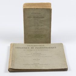
Leymerie, A. [F. G. A.]
Description géologique et paléontologique des Pyrenées de la Haute-Garonne accompagnée d'une carte topographique et géologique à l'echelle 1:200.000 et d'un Atlas...
Toulouse, Privat, 1878, 1881. In two volumes. Text (1881) 8vo (24.0 x 16.0 cm). Atlas (1878) oblong 4to (23.5 x 31.5 cm). 1,027 pp.; 51 lithographed plates of which 11 tinted or coloured (and of which 30 are on fossils), including a large folded transection of the Pyrenees, Haute Garonne, and the large coloured geological map (with 20 colours) mounted on linen. Original printed wrappers (text) and boards (atlas).
Read more
Tokunaga, S. et al.
Report of the First Scientific Expedition to Manchoukuo. Under the leadership of Shigeyasu Tokunaka. June - October 1933. Section II [Geology]. Part I-IV. [Complete].
Tokyo, Asahi, 1934-1939. Four volumes in four. 4to (26.0 x 19.0 cm). Ca. 700 pp. with 124 plates and three folding coloured maps. Original uniform printed stiff wrappers.
Read more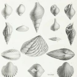
Orbigny, A. D. d'
Voyage dans l'Amérique méridionale (le Brésil, la république orientale de l'Uruguay, la république Argentine, la Patagonie, la république du Chili, la république de Bolivia, la république du Perou). Exécuté dans le cours des années 1826, 1827, 1828, 1829, 1830, 1831, 1832 et 1833. 4.e Partie: Paléontologie.
Paris, P. Bertrand; Strasbourg, V. Levrault, 1842. Folio (34.0 x 25.9 cm). Title page, half-title, 182 pp.; 22 finely lithographed plates. Spine with gilt lines and title. Later blind linen spine over contemporary boards. Marbled endpapers. Speckled edges.
Read more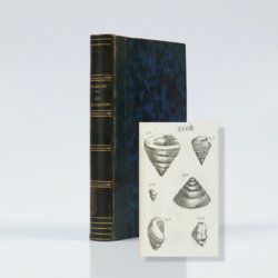
Bourguet, [L.]
Traité des pétrifications. Nouvelle édition, corrigée et augmentée.
Paris, Claude-Antoine Jombert, 1778. 8vo (19.7 x 12.3 cm). Half-title, title page, 349 pp. (xvii, 326, [vii], and 4; 16 with advertisements); 441 engravings on 60 plates. 19th-century half calf over marbled boards. Spine with gilt ornamental lines and title. Marbled endpapers. Speckled edges.
Read more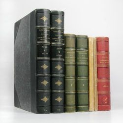
Dufrenoy, [O. P. A.] and [J. B. A. L. L.] Élie de Beaumont
Explication de la carte géologique de la France. Volumes I-IV (text and atlas), and two maps. [Complete].
Paris, Imprimerie Royale, Imprimerie Nationale, 1841-1879. Four volumes in seven, and a large map in six folded sheets, each ca. 70 x 205 cm (including borders) with linen covers. Large 4to (four text volumes; ca. 27.5 x 21.0 cm); folio (two atlas volumes, 26.8 x 35.7 cm). Tome premier: Paris, Imprimerie Royale, 1841. Large 4to. xxii, 825 pp., 71 text engravings (mainly profiles); Tome deuxième: Paris, Imprimerie Nationale, 1848. Large 4to. xii, 813 pp., 105 text engravings (mainly views and profiles), one large, folded chromolithographed geological map (finished by hand) of France (printed surface: 57 x 54 cm, and consisting of 15 smaller sections, mounted on linen and folded) bound in the rear; Tome troisième. Première partie (by Dufrénoy): Paris, Imprimerie Nationale, 1873. Large 4to. viii, 231 pp., 18 text engravings (mainly profiles). Printed wrappers. Tome quatrième. Seconde partie. Végétaux fossiles du terrain houiller (by Zeiller): Paris, Imprimerie Nationale, 1879. Large 4to. 185 pp. Printed wrappers; Tome quatrième. Atlas (in two volumes). Première partie. Fossiles principaux des terrains (by É. Bayle). Seconde partie. Végétaux fossiles du terrain houiller (by Zeiller): Paris, Imprimerie Nationale, 1878. Folio. Title page, half title to first part. 86 lithographed plates with explanatory text leaves, numbered I-LXXXVI; 90 lithographed plates with explanatory text leaves, numbered LXXXVII-CLXXVI (the last 16 on plants), for a total of 176 plates. Volumes I, II, and IV plate volumes in near uniform contemporary dark-green pebbled morocco over marbled boards. Spines with five gilt-stippled bands, and gilt title. Marbled endpapers. The text volumes with top edge gilt, atlases with marbled top edges. Text volumes III and IV in original printed wrappers. The large chromolithographed map in six sheets (approximately 218 x 223 cm) is contained in a contemporary, book-like crimson box with gilt-lettered spine, with raised bands and patterned paper sides.
Read more
