Buvignier, [N.] A.
Statistique géologique, minéralogique et paléontologique du Département de la Meuse.
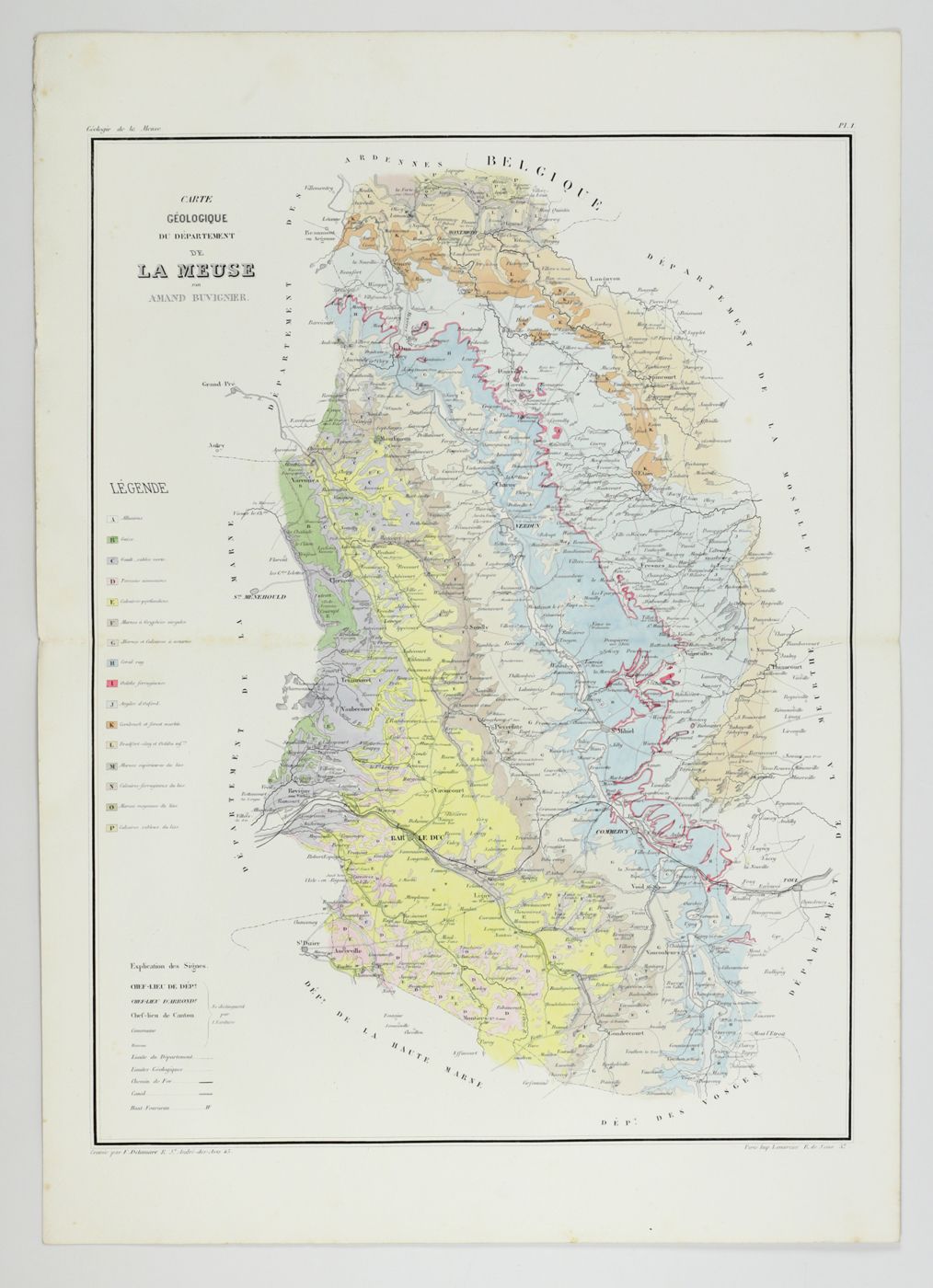
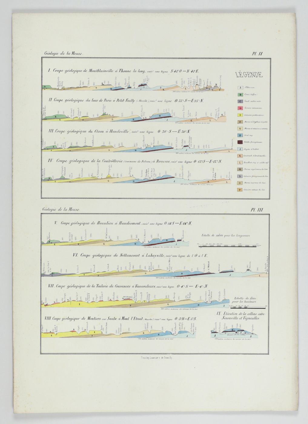
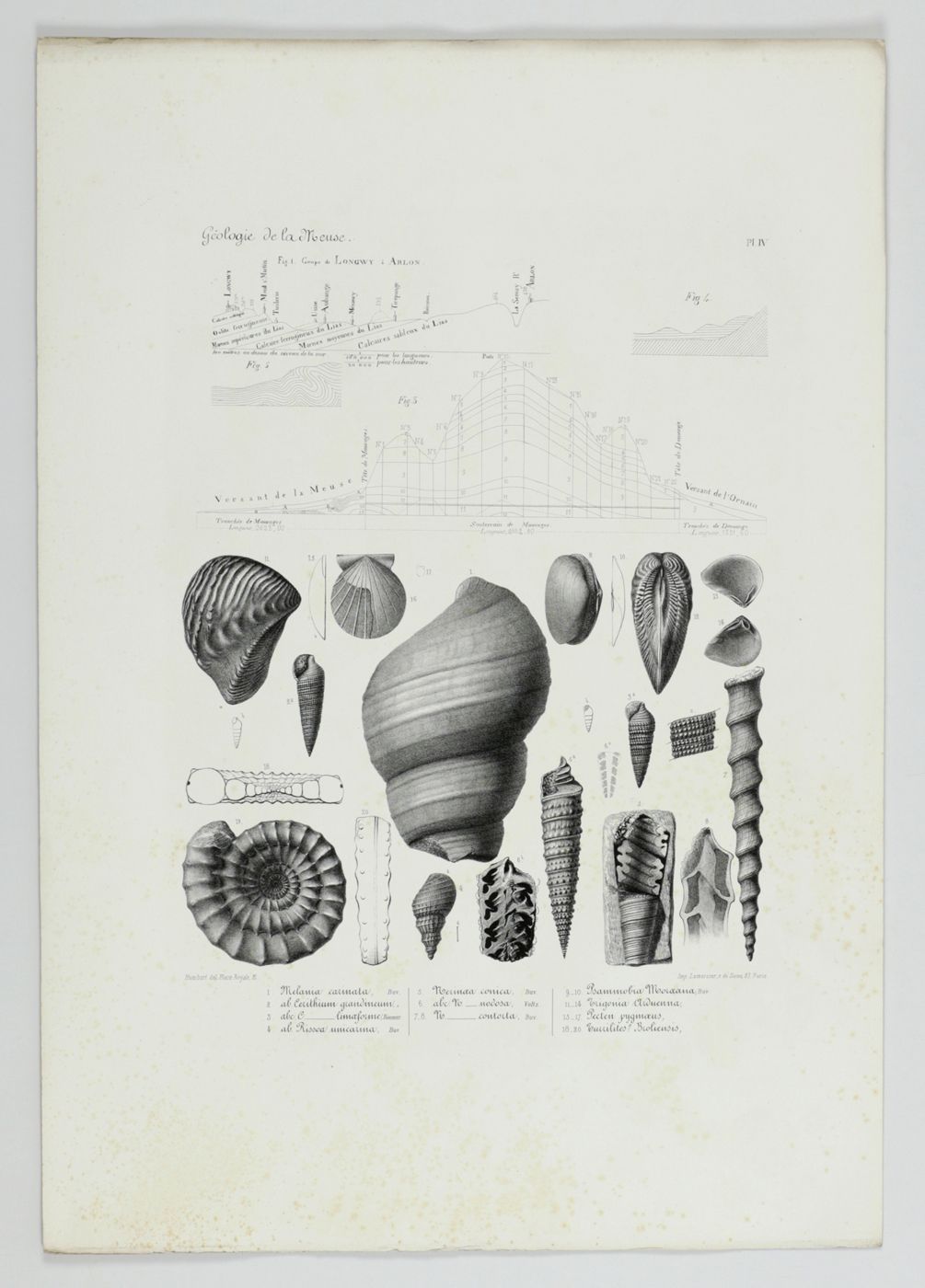
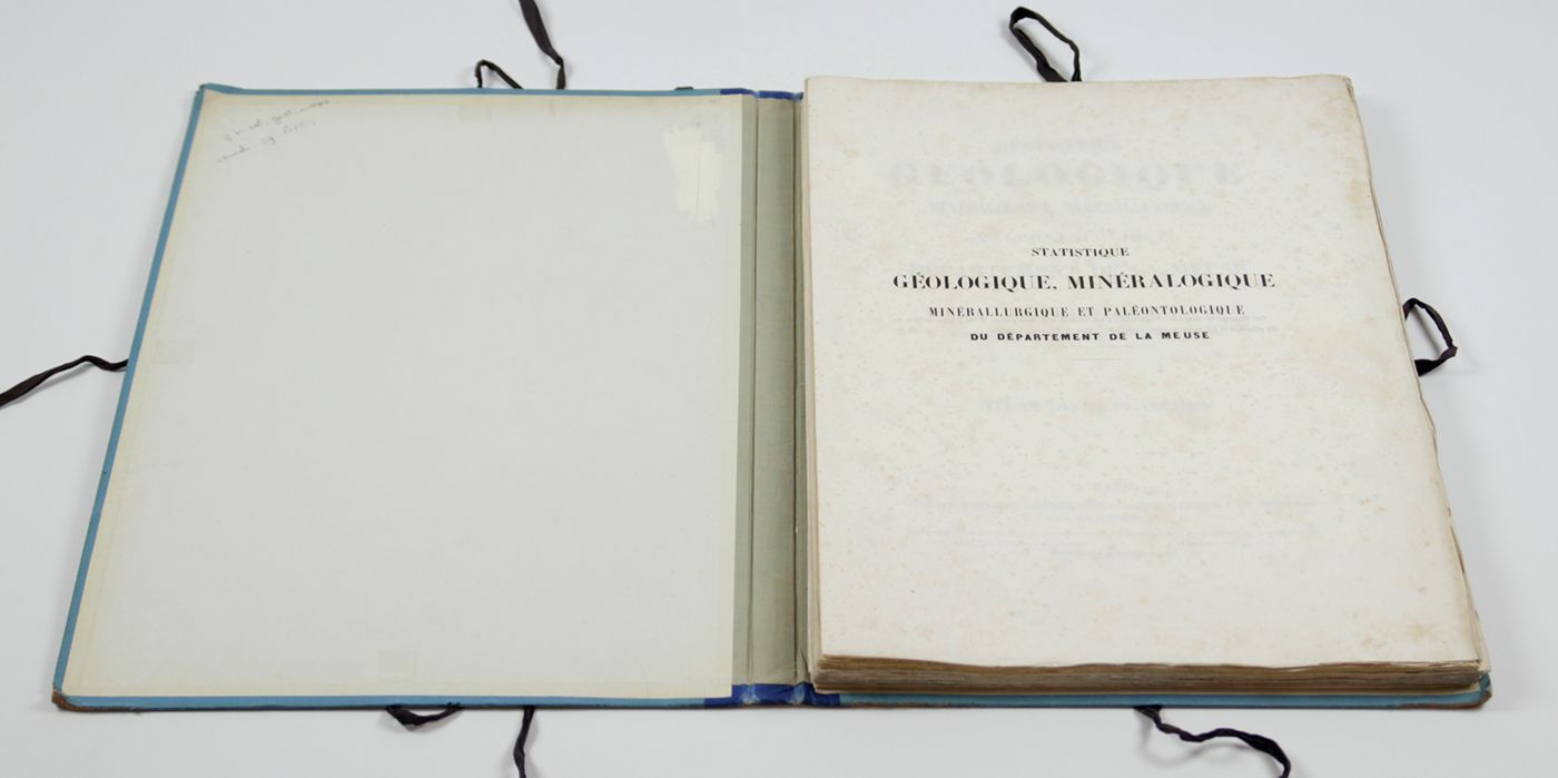
Paris, J. B. Baillière, 1852. Folio (45.0 x 31.0 cm). Atlas with title page and 52 pp. of explanatory text; 29 fine lithographed plates of fossils; one double-sized hand-coloured geological map, two hand-coloured profiles (separately numbered, but on one sheet), for a total of 32 "plates". Original blue quarter cloth portfolio with blue boards. Front board with printed title.
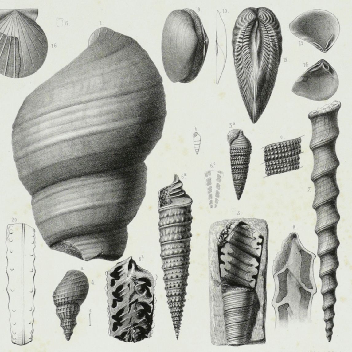
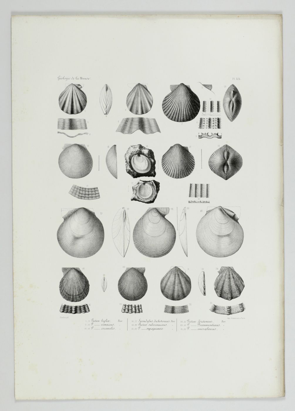
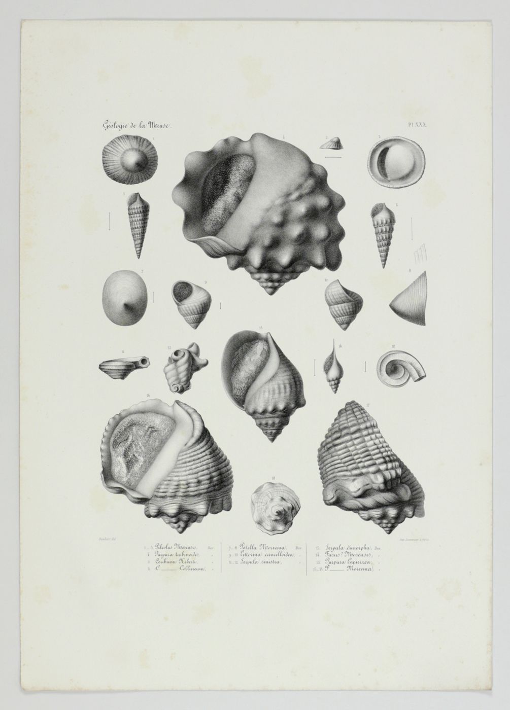
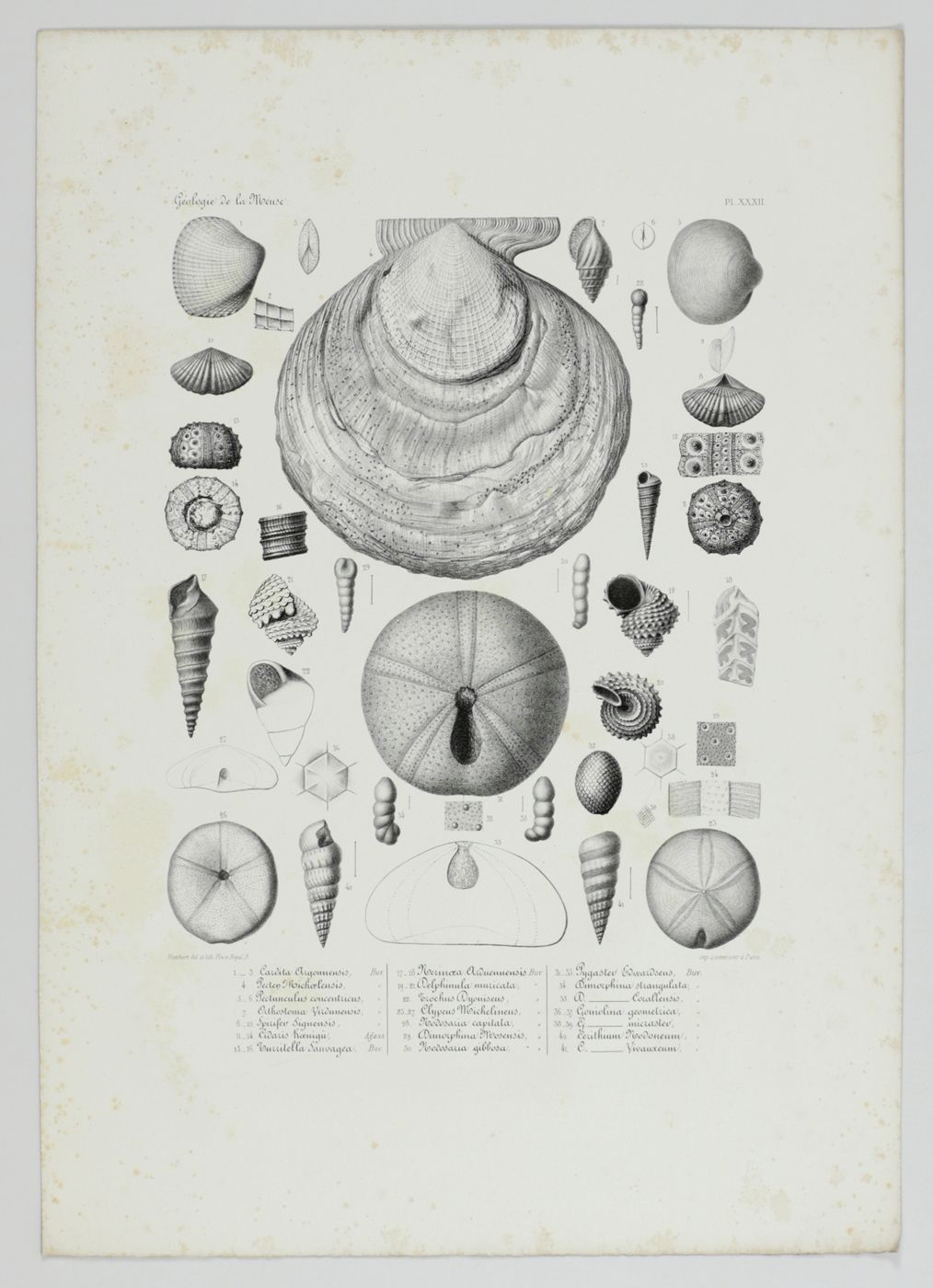
This is the grand atlas of a work that not only includes one of the first geological maps and profiles of the Meuse River in the northeastern part of France, but also the complete descriptions and fine illustrations of numerous new and poorly known Jurassic molluscs, in particular extremely well-preserved gastropods and bivalves. The species descriptions are included in the accompanying text leaves (plate explanations). The map is numbered I; the two profiles II-III; and the plates with shells (the first with some additional profiles, and an ammonite) IV-XXXII. The suggestion, by another antiquarian, that there are 32 shell plates and a map is incorrect. This copy is complete. The French geologist and palaeontologist Nicolas-Armand Buvignier (1808-1880) wrote several works on fossil molluscs and has the palaeontologically significant snail genus Buvignieria named after him. Not present is the octavo general description of the geology of the département. Apart from very light marginal foxing a very good, complete atlas. Cat. BM(NH) 1, p. 294; Nissen ZBI, 6556.

![image for Die Gross-Schmetterlinge der Erde. Abteilung I. Die Groß-Schmetterlinge des palaearktischen Faunengebietes. Band I-IV. [Complete original edition].](https://schierenberg.nl/media/cache/product_thumb/75996/75996.jpg)
![image for Botanica Pharmaceutica exhibens plantas officinalis quarum nomina indispensatoris recentur, cum Iconibus… Plate 245 <em>Cannabis sativa</em>. [Hemp].](https://schierenberg.nl/media/cache/product_thumb/70101/70101_x.jpg)

