
Mountains
45 items found
Suter, J. R.
Helvetiens Flora, worinn alle in Hallerischen Werke enthaltenen und seither neuentdeckten schweizer Pflanzen nach Linné's Methode aufgestellt sind.
Zürich, Orell, Fuessli, 1802. Two volumes in two. 12mo (14.2 x 8.8 cm). lxiii, 345, [xviii]; 416 pp. Uniform, later vellum. Spines with contemporary red morocco label with gilt title. All edges gilt and embossed with floral pattern.
Read more
Allemann, F.
Geologische Karte Fürstentum Liechtenstein.
[Vaduz], Regierung des Fürstentums Liechtenstein, 1953. Large (102.0 x 67.0 cm), folded map, consisting of 25 rectangular sheets in full colour, mounted on linen. Handwritten and stamped label on the front-facing part of the linen map verso.
Read more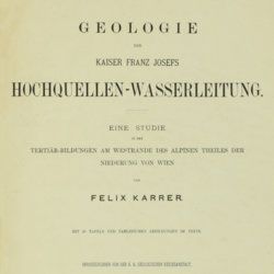
Karrer, F.
Geologie der Kaiser Franz Josefs Hochquellen-Wasserleitung. Eine Studie in den Tertiär-Bildungen am Westrande des alpinen Theiles der Niederung von Wien.
Wien, Hölder, 1877. Large 4to (33.5 x 25.5 cm). xiii, 420 pp.; 96 text engravings, 20 folded profiles, maps and lithographed plates, mostly coloured and several very large (size up to 32 x 100 cm), seven folded charts and tables. Later half cloth with paper label on the spine.
Read more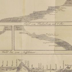
Oeynhausen, C. von and H. von Dechen and H. von La Roche
Geognostische Umrisse der Rheinländer zwischen Basel und Mainz mit besonderer Rücksicht auf das Vorkommen des Steinsalzes, nach Beobachtungen entworfen auf einer Reise im Jahre 1823 gesammelt.
Essen, G. Bädeker, 1825. Two volumes in one. 8vo (19.8 x 12.0 cm). 782 pp.; one folding lithographed plate with several geological profiles. Contemporary half cloth over marbled boards. Paper label with the title in an old hand on the spine. Original endpapers.
Read more
Nikolsky, A. M. [Nikolski, Nikolskii]
Faune de la Russie et des pays limitrophes fondée principalement sur les collections du Musée Zoologique de l'Académie Impériale des Sciences de Petrograd. Reptiles (Reptilia). Volumes I-II. [Complete].
Petrograd, Musée Zoologique de l'Académie Impériale des Sciences de Petrograd, 1915-1916. Two volumes in two. 8vo (25.0 x 16.6 cm). 884 [534; 350] pp.; 133 [69; 64] text engravings, 17 [9; 8] plates. Uniform original printed wrappers.
Read more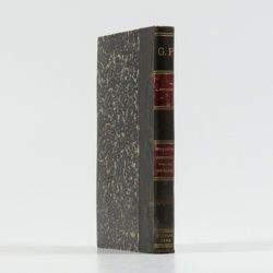
Rothpletz, A.
Ein geologischer Querschnitt durch die Ost-Alpen nebst Anhang über die sog. Glarner Doppelfalte.
Stuttgart, E. Schweizerbart (E. Koch), 1894. 8vo (22.4 x 15.4 cm). iv, 208 pp.; two full colour folded profiles of which one measuring 22.5 x 352.0 cm (!), 115 text illustrations. Contemporary half cloth over marbled boards. Gilt lines and two red morocco labels with gilt title on the spine. Edges speckled.
Read more
Fuchs, W.
Die Venetianer Alpen. Ein Beitrag zur Kenntniss der Hochgebirgte, met einen geognostischen Karte und Gebirgteprofilen in achtzehn Tafeln.
Solothurn, Jent & Gassmann, 1844. Oblong folio (29.8 x 35.5 cm), [4], 60 pp.; 18 mostly hand-coloured engraved maps and plates. Text pages bordered with putti and goddesses. 19th century iridescent blue blind cloth.
Read more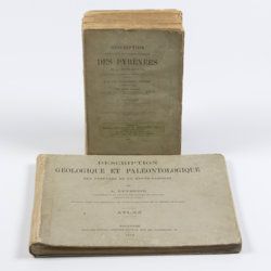
Leymerie, A. [F. G. A.]
Description géologique et paléontologique des Pyrenées de la Haute-Garonne accompagnée d'une carte topographique et géologique à l'echelle 1:200.000 et d'un Atlas...
Toulouse, Privat, 1878, 1881. In two volumes. Text (1881) 8vo (24.0 x 16.0 cm). Atlas (1878) oblong 4to (23.5 x 31.5 cm). 1,027 pp.; 51 lithographed plates of which 11 tinted or coloured (and of which 30 are on fossils), including a large folded transection of the Pyrenees, Haute Garonne, and the large coloured geological map (with 20 colours) mounted on linen. Original printed wrappers (text) and boards (atlas).
Read more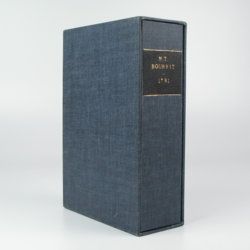
Bourrit, M. T.
Description des Alpes, Pennines et Rhetiennes; dédiée a.s.m. très-chrétienne Louis XVI, roi de France et de Navarre. Tome premier - second. [Complete].
Genève, J. P. Bonnant, 1781. In two volumes. 8vo (21.5 x 13.8 cm). xix, 247 pp.; [ii], 285 pp.; eight engraved plates, mainly of glaciers, and one folded engraved map of the Alps, several wood engraved vignettes in the text. Original uniform blind publishers' wrappers. Spines renewed with later printed labels. Contained in a later blue cloth slipcase (23.2 x 15.8 x 6.9 cm) with black morocco label with gilt title.
Read more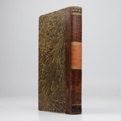
Wahlenberg, G.
De vegetatione et climate in Helvetia Septentrionali inter flumina Rhenum et Arolam observatis et cum summi septentrionis comparatis tentamen.
Turici Helvetorum (Zürich), Fuessli, 1813. 8vo (20.5 x 12.1 cm). xcviii, 200 pp.; one folding table, three folded engraved plates. Contemporary half calf over marbled boards. Spine with gilt ornaments at head and food; red morocco label with gilt title. All edges red.
Read more
Tollmann, A.
Das Neogen am Südwestrand des Leithagebirges zwischen Eisenstadt und Hornstein. Dissertation zur Erlangung des Doktorgrades an der Philosophischen Fakultät der Universität Wien.
Wien, [not published], 1953. Small folio (29.8 x 21.0 cm). 226 pp.; 28 text figures (tipped in), three large folded maps (one hand-coloured), five folded tables and graphs. Black half cloth. Hand-written label on the spine.
Read more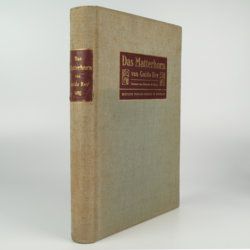
Rey, G.
Das Matterhorn. Vorwort von E. de Amicis with geologische Erläuterungen by V. Novarese.
Stuttgart and Leipzig, Deutsche Verlags-Anstalt, 1905. 4to (29.2 x 21.0 cm). xi, 258 pp.; 35 plates of which 14 are nicely tinted photographic plates after water-colours, mounted on black paper, all by Edoardo Rubino and 11 photographs (most by Vittorio Sella and a few by G. Rey) and ten photographic plates from drawings also by Edoardo Rubino. Furthermore there are 13 images of drawings in the text also by Edoardo Rubino [complete]. Original cloth with bevelled edges, gilt mounted title piece on front board and gilt-lettered spine label. Mottled olive endpapers. Top edge gilt.
Read more
