Anville, [J. B. B.] d'
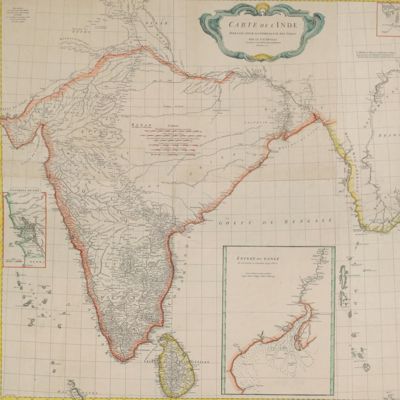
Carte de l'Inde. Dressée pour la Compagnie des Indies par le Sr. d'Anville, Secretaire de S.A.S. Mgr. le Duc d'Orléans. Paris, Novembre 1752.
Paris, Compagnie des Indes, 1752. Oblong broadsheet (97.2 x 111.5 cm), printed engraving with additional, contemporary hand-colouring (printed surface 87.8 x 104.5 cm).
An unusually large, early map of the Indian subcontinent and adjacent parts of Asia and the Indian Ocean. Made by the French cartographer Jean Baptiste Bourguignon d'Anville (1697-1782), for the French East India Company. The map was designed by the French engraver Hubert-François Bourguignon, commonly known as Gravelot (1699-1773), and engraved by De Lafosse (perhaps the engraver and (later) architect Jean-Charles Delafosse [1734-1791]). Eight smaller maps (insets) show, in more detail, parts of special interest, e.g., the town of Goa, the mouth of the Ganges (with soundings), and the Strait of Malacca, near Banda Aceh (on the edge the area covered by the large map of India itself). Much of the interior of India, in particular a triangle south of the Ganges, extending to the mouth of the Krisha River, was still unknown. D'Anville opposed the inclusion of unverified facts, and left this area almost entirely blank. Printed on two sheets; the sheets assembled neatly. Some restorations. Three weak, old folds; outer margins a bit soiled, with minimal fraying and a few very short tears, otherwise very good. Complete, coloured copies of this map are very uncommon, if not rare - we found no other copies on the internet. Not in Brunet.

![image for Beschrijving van een nieuwen zoetwater-visch van Borneo, <em>Osteoglossum formosum</em>. [AND] Beschrijving van vier oost-Indische zeevisschen behoorende tot het geslacht <em>Amphacanthus</em>. [AND] Overzigt der uit de Sunda- en Moluksche zeeën bekende visschen van de geslachten <em>Amphiprion, Premnas, Pomacentrus, Clyphisodon, Dascyllus</em> en <em>Heliases</em>.](https://schierenberg.nl/media/cache/product_thumb/70391/70391_x.jpg)

![image for Voyage dans le sud-ouest de Madagascar. Conférence faite à la Société de Géographie le 5 janvier 1900. [AND] Pérégrinations à Madagascar.](https://schierenberg.nl/media/cache/product_thumb/29837/29837_x.jpg)

![image for Annalen des Ackerbaues herausgegeben von Albrecht Thaer. [AND] Annalen der Fortschritte der Landwirthschaft in Theorie und Praxis herausgegeben von Albrecht Thaer. [Together in 16 volumes].](https://schierenberg.nl/media/cache/product_thumb/32530/32530_x.jpg)
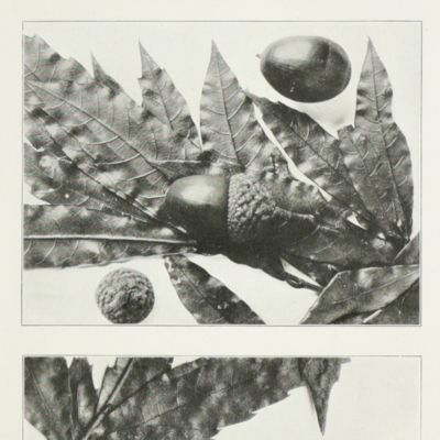
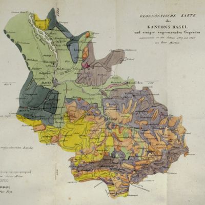
![image for Catalogue des livres rares et précieux composant la bibliothèque de feu M. Jacques-Charles Brunet. Première Partie. Livres rares et précieux. Belles reliures anciennes et modernes. [AND] Deuxième partie. Ouvrages de divers genres. Histoire littéraire. Bibliografie. [Complete].](https://schierenberg.nl/media/cache/product_thumb/71366/71366.jpg)

![image for Over de zoogdieren van den Indischen Archipel. [On the mammals of the Malay Archipelago].](https://schierenberg.nl/media/cache/product_thumb/27651/27651.jpg)
![image for <em>Opuntia polyacantha [Pricklypear Cactus].</em>](https://schierenberg.nl/media/cache/product_thumb/70122/70122_x.jpg)
![image for Aux amateurs de grands vins de Champagne en Belgique. [AND] An original drawing by Massonet.](https://schierenberg.nl/media/cache/product_thumb/71386/71386_x.jpg)
![image for De Bare'e sprekende Toradjas van Midden-Celebes. Tweede, geheel omgewerkte druk. [2nd, revised edition. Complete, in five volumes].](https://schierenberg.nl/media/cache/product_thumb/75785/75785_x.jpg)
![image for Bijdragen tot de kennis van de Lemuridae of Prosimii. [Titled <em>Bydragen tot de kennis van de Lemuridae</em> on front board].](https://schierenberg.nl/media/cache/product_thumb/72193/72193_x.jpg)
![image for Geognostische Karte von Württemberg [AND] Begleitworte zur geognostischen Specialkarte von Württemberg.](https://schierenberg.nl/media/cache/product_thumb/28715/28715.jpg)
![image for Jugendstil design: original design from Vienna. ‘Holz- und Brandmal-Vorlage’. Very large plate. [Irises and goose].](https://schierenberg.nl/media/cache/product_thumb/72549/72549_x.jpg)
![image for Almorah jay. <em>Garrulus vigorsii</em>. [J. E. Gray's <em>Illustrations of Indian Zoology</em>, plate 22].](https://schierenberg.nl/media/cache/product_thumb/74039/74039_x.jpg)
![image for Revision of the Jurassic Cephalopod Fauna of Kachh (Cutch). Part IV. [Family Perisphinctidae to Family Olcastephanidae].](https://schierenberg.nl/media/cache/product_thumb/76448/76448_x.jpg)


