Regional Travel
32 items found
Brown, E.
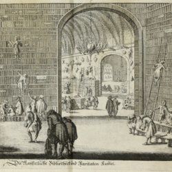
[Wunderkammer - Giant Library] Durch Niederland, Teutschland, Hungarn, Serbien, Bulgarien, Macedonien, Thessalien, Oesterreich, Steirmarck, Kärnthen, Carniolen, Friaul, &c. gethane ganz sonderbare Reisen...
Nürnberg, Johann Ziegler, 1685. 4to (20.3 x 16.5 cm). Engraved title, letterpress title in black and red; [viii], 334, [xii] pp.; 18 engraved plates, of which several larger, folding. Later blind vellum.
Read more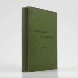
Wade, H. T.
With boat and gun in the Yangtze Valley (second edition) by Henling Thomas Wade (with special chapters by valued contributors).
Shanghai, Shanghai Mercury, 1910. 4to (27.8 x 21.8 cm). vi, 284 pp.; eight maps and plates, numerous text figures. Original full cloth with printed text on the front board. Purple endpapers.
Read more
Hamilton, W.
Voyage à la cote septentrionale du Comté d'Antrim en Irlande, et à l'ile de Raghery, contenant l'histoire naturelle de ses productions volcaniques & plusieurs observations sur les antiquités & moeurs de ce pays... auquel on a ajouté l'essai sur l'oryctographie du Derbyshire par M. Ferber, traduit de l'Allemand.
Paris, Cuchet, 1790. 8vo (19.6 x 12.5 cm). viii, 239 pp.; engraved folding plate showing several geological layers of Derbyshire. Contemporary full mottled calf. Spine rich gilt with floral vignettes, small red morocco label with gilt title. Marbled endpapers, red edges.
Read more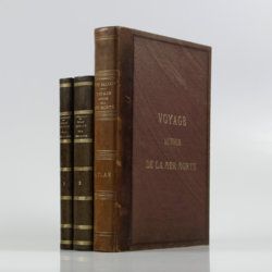
Saulcy, [L.] F. [J. C.] de
Voyage autour de la Mer Morte et dans les terres bibliques exécuté de décembre 1850 à avril 1851. Relation de voyage; atlas. [Complete].
Paris, Gide et J. Baudry, 1852-1853. In two text volumes and one atlas volume. 8vo (24.5 x 16.0 cm [text]). 1054 pp. [399; 655]). Folio/large 4to (31.0 x 23.7 cm [atlas]). 172 pp. [4, vii, 20, i-iv, 5-19; xxvi, 96]; 15 maps on 14 sheets (one double-sized); 61 (LVII; 4) lithographed plates (several tinted). Text in near contemporary uniform half calf over marbled boards. Spines with gilt bands and title; Atlas in contemporary half morocco over grained, cloth with gilt title on the front board and spine. Marbled endpapers. Original printed wrappers of the text volumes bound in.
Read more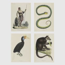
Temminck, C. J. (ed.)
Verhandelingen over de natuurlijke geschiedenis der Nederlandsche overzeesche bezittingen, door de Leden der Natuurkundige commissie in Indië en andere schrijvers. Uitgegeven op last van de Koning.
Leiden, S. Luchtmans and J. Luchtmans, 1839-1844. Three volumes in five, including a matching drop box. Folio (42.6 x 29.1 cm). 1379 pp.; 258 plates on 257 sheets (and one double, not counted), of which all but 81 finely hand-coloured, and four maps, of which one double-sized, and all but one partly hand-coloured. Uniform contemporary dark green half morocco over grained boards. Spines with five raised bands; gilt ornaments at head and foot, and gilt title. Speckled edges.
Read more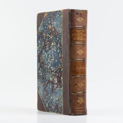
Duppa, R.
Travels on the continent, Sicily and the Lipari Islands. Second edition.
London, Longman, Rees, Orme, and Co., 1829. Large 8vo (26.8 x 17.2 cm). x, 494, [ii] pp.; 21 fine engraved plates, and 34 text engravings. Contemporary grained half morocco over marbled boards. Spine with five raised, stipple-gilted bands; compartments with gilt vignettes and a brown morocco label with gilt title.
Read more
Ogilvie-Grant, W. R. (ed.). a. o.
Reports of the collection made by the British Ornithologists' Expedition and the Wollaston Expedition in Dutch New Guinea, 1910-1913.
London, Francis Edwards, 1916. In two volumes. Large 4to (33.2 x 25.6 cm). Text; 41 plates of which 13 in chromolithography; 76 text figures; two fine, coloured, double-sized maps. Original uniform printed wrappers.
Read more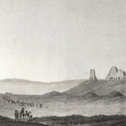
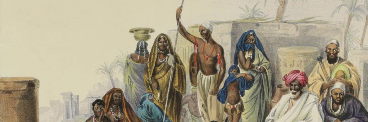
Rüppell, E.
Reisen in Nubien, Kordofan und dem petraeischen Arabien vorzueglich in geographisch-statisticher Hinsicht.
Frankfurt [am Main], Friedrich Wilmans, 1829. Large 8vo (23.0 x 13.1 cm). xxvi, 388 pp.; eight folded engravings and five maps on four folded sheets (combined numbering is 1-12, with two maps on plate 10). In an expertly made period-style speckled half calf binding. Marbled boards. Spine with gilt chains and vignettes, and red morocco label with gilt title.
Read more
Forbes, J. D.
Reisen in den Savoyer Alpen und in anderen Theilen der Penninen-Kette, nebst Beobachtungen über die Gletscher.
Stuttgart, Schweizerbart, 1845. 8vo (21.0 x 13.3 cm). xii, 386 pp.; seven lithographed plates (of which one hand-coloured) and two folded lithographed maps depicting the Chamonix Alps. Early 20th-century cloth with mounted title and backstrip from original printed boards and spine.
Read more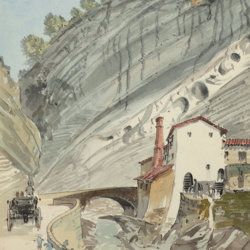
["JAM" (R. de Bouillé, Comte)]
[Original watercolour sketches of French landscapes]
[France], no place, no publisher, ca. 1863-1890. 13 oblong sheets (22.3 x 29.2 cm), all with fine watercolour paintings, either full-sized, or smaller, in a drawn rectangular frame. And one drawing on slightly smaller paper, more sketchy, in pencil.
Read more
