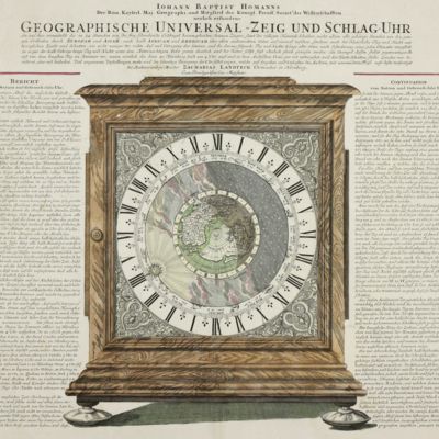
Homann, J. B.
Geographische Universal-Zeig und Schlag-Uhr.
Nuremberg, Iohann Baptist Homann [ca. 1720]. Broadsheet (printed surface 49.5 x 57.5 cm) printed on two carefully joint leaves. With original hand-colouring. Framed (frame size 64.5 x 72.0 cm).
A detailed engraving by the German cartographer Johann Baptist Homann (1664-1724), with his accompanying explanatory text. It describes and illustrates a clock made by the watchmaker, Zacharias Landteck (1670-1740), which shows the times of sunrise and sunset on any day and at any location in the northern hemisphere. Only one copy of Landteck's clock is extant. The map still shows California as an island. First published in around 1705. It is not as part of Homann's magnum opus, the Grosser Atlas ueber die ganze Welt, as claimed by some. This is the second edition, which differs only in additionally recording Homann's membership of the Königlich Preußische Sozietät der Wissenschaften (he was elected in 1715). A few insignificant spots, otherwise very good; the colouring contemporary and carefully done.


