Earth Sciences - Geology
155 items found
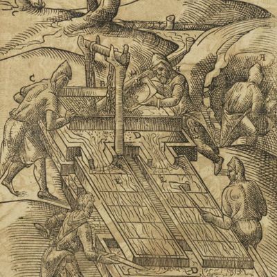
Marsigli, L. F. Comte de (Marsilli, L. Graave van)
Natuurkundige Beschryving der Zeeën.
's Gravenhage, De Compagnie, 1786. Folio (41.6 x 26.0 cm). Half-title, a nice hand-coloured engraved allegorical frontispiece, title page with woodcut vignette. [ii], xxvi, 216 pp.; seven mostly folded engravings, five hand-coloured engraved maps and profiles, and 40 beautifully hand-coloured engraved plates (for a total of 52 plates and maps), woodcut endpieces and capitals. Contemporary half calf over speckled boards. Spine with six raised bands, compartments with gilt floral vignettes and burgundy morocco label with gilt title.
Read more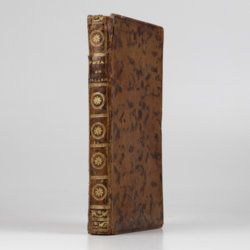
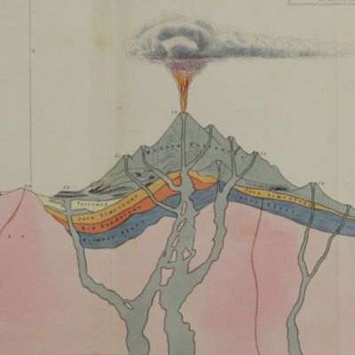
Hamilton, W.
Voyage à la cote septentrionale du Comté d'Antrim en Irlande, et à l'ile de Raghery, contenant l'histoire naturelle de ses productions volcaniques & plusieurs observations sur les antiquités & moeurs de ce pays... auquel on a ajouté l'essai sur l'oryctographie du Derbyshire par M. Ferber, traduit de l'Allemand.
Paris, Cuchet, 1790. 8vo (19.6 x 12.5 cm). viii, 239 pp.; engraved folding plate showing several geological layers of Derbyshire. Contemporary full mottled calf. Spine rich gilt with floral vignettes, small red morocco label with gilt title. Marbled endpapers, red edges.
Read more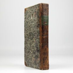
Phillip, A.
Arthur Phillips Reise nach der Botany-Bay, nebst Auszügen aus den Tagebüchern der neuesten Brittischen Entdecker in der Südsee.
Hamburg, Benjamin Gottlob Hoffmann, 1791. 8vo (20.4 x 11.1 cm). [xiv], viii, [9]-264 pp.; one engraved portrait as a frontispiece, one engraved title vignette, eight engraved plates and one hand-coloured folded map. Contemporary mottled half calf over marbled boards. reen moroccolabel with gilt title on the spine. Blue endpapers.
Read more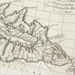
Lesseps, [J. B. B.] de
Herrn von Lesseps Gefährten des Grafen de la Perouse Reise durch Kamtschatka und Sibirien nach Frankreich. Aus dem Französischen übersetzt. Mit Anmerkungen von Johann Reinhold Forster.
Berlin, Voss, 1791. 8vo (22.4 x 14.5 cm). xxviii, 302 [303-544] pp.; two engraved, folded maps, one folded table. Original blind boards.
Read more
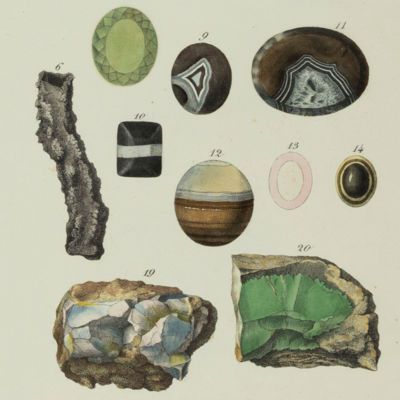
Widenmann, J. F. W.
Handbuch des oryktognostischen Theils der Mineralogie.
Leipzig, Siegfried Lebrecht Crusius, 1794. Thick 8vo (19.6 x 12.2 x 6.0 cm). xiv, [vi], 1,040, [4], [xv] pp.; two folded engravings, one with 74 different colours. Contemporary marbled boards. Spine with gilt lines and morocco label with gilt title. All edges red.
Read more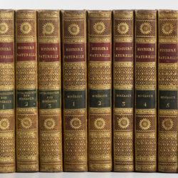
Sonnini, C. S.
Histoire naturelle générale et particulière, par Leclerc de Buffon; nouvelle edition accompagnée de notes, et dans laquelle les supplémens sont insérés dans le premier texte, à la place qui leur convient. Ouvrage formant un cours complet d'histoire naturelle; redige par C. S. Sonnini, membre de plusieurs sociétés savantes. Tomes Mineraux 1-16. [Théorie de la terre 1-3; Epoques de la nature; Introduction a l'histoire des minéraux 1-3; Mineraux 1-9].
Paris, Dufart, An VIII (1798) - X (1800). 16 parts in 16. 8vo (19.5 x 12.2 cm). Engraved frontispiece, 7156 pp.; nine engraved plates, four folded maps. Contemporary uniform full tree calf. Boards with gilt ornamented borders and gilt dentelles. Rich gilt spines, gilt titles on two (red and black) morocco labels, marbled flyleaves, all edges speckled red on yellow.
Read more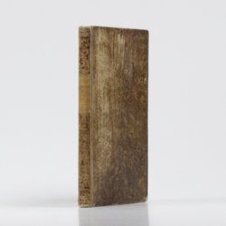
[Lehmann, J. G.]
Darstellung einer neuen Theorie der Bezeichnung der schiefen Flächen im Grundriss oder der Situationszeichnung der Berge.
Leipzig, Johann Benjamin Georg Fleischer, 1799. 8vo (19.6 x 12.0 cm). xx, 172 pp.; four large, folded, engraved plates. Contemporary full tree calf. Spine with morocco label with gilt ornamental lines and title. Edges pale yellow.
Read more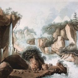
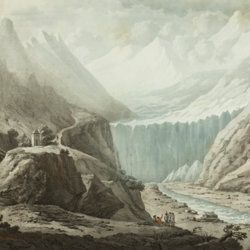
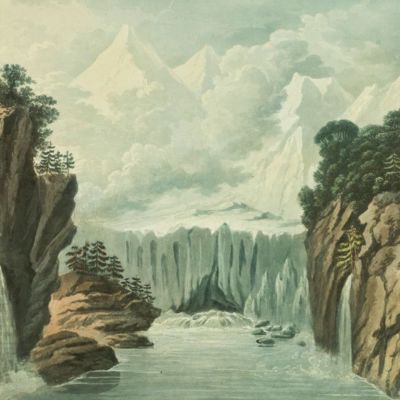
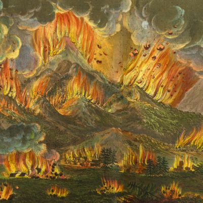
Belanger, L. and P. Vanlerberghe and S. Malgo
View of the torrent of the Lutschinen, and of the glaciers where it takes its source – Vue du torrent de la Lutschinen en Suisse, et des glaciers ou il prend sa source.
London, G. & W. Nicoll, 1800. Broadsheet (71.0 x 56.0 cm). Aquatint, finished by hand.
Read more
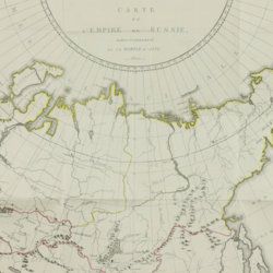
Storch, H.
Tableau historique et statistique de l'empire de Russie à fin du dix-huitième siècle. Edition française.
Basle, J. Decker, and Paris, C. Pougens, 1801. Two volumes in two. 8vo (19.6 x12.3 cm). 1,004 pp. [xxii, 407, 80; 423, 72]; two large, partly coloured folded maps (the largest with printed dimensions 67 x 36.5 cm), three folded tables. Uniform contemporary tree-calf. Spines rich gilt with gilt title on blue morocco label. Marbled endpapers. Edges yellow, speckled with red.
Read more