Palaeontology
90 items found

[Geological map]
Geognostische Karte von Württemberg [AND] Begleitworte zur geognostischen Specialkarte von Württemberg.
Stuttgart, Das Königliches Statistisch-topographisches Bureau, Kohlhammer, Kleeblatt, 1863-1892. With 54 chromolithographed folded geological maps, all mounted on linen, numbered 1-48, 50-55, in two original, uniform burgundy boxes with gilt title on the lid. [AND] the "Begleitworte" 34 parts in one. Large 8vo (25.7 x 19.5 cm). Stuttgart, Königlich Statistischen Landesambt, (1865-1892). ca. 1,000 pp., and five hand-coloured wood-engraved or lithographed maps or geological profiles, and four wood-engraved plates. Contemporary half cloth over marbled boards. Spine with gilt title, ornaments, and the Württemberg coat-of-arms; patterned endpapers, and marbled edges.
Read more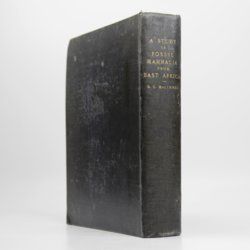
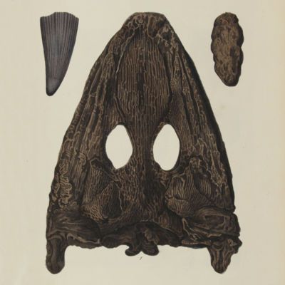
MacInnes, D.G.
A study of fossil Mammalia from East Africa [original manuscript].
Unpublished [n.d., but ca 1938.] 4to (26.0 x 20.4 cm). Original typed manuscript with 336 pp.; 143 original photographs in various sizes, and some original drawn maps. Full contemporary dark blue cloth with gilt title on spine.
Read more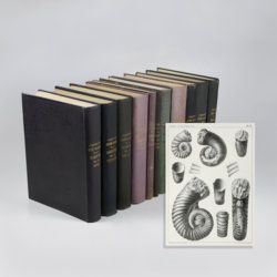
Barrande, J.
Systême Silurien du Centre de la Bohême. Première partie: Recherches paléontologiques. Continuation éditée par le Musée Bohême. Vol. II. Classe des mollusques, ordre des céphalopodes. Texte et 544 planches.
Prague, Musée Bohême, 1867-1877. 11 parts in 11. Large 4to and folio (32.5 x 25.5). 3,583 pp.; 545 lithographed plates (including 240bis) with explanatory text leaves. Original near uniform blind-tooled cloth with gilt title on the spines.
Read more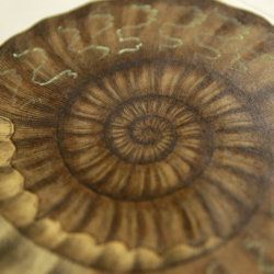
Sowerby, J.
The mineral conchology of Great Britain; or coloured figures and description of those remains of testaceous animals or shells, which have been preserved at various times and depths in the Earth. Volumes I - II.
London, J. Sowerby, 1812-1818. Two volumes in two. 8vo (23.2 x 15.5 cm). 482 pp. [I: 234, x; II: 235, iii]. 205 hand-coloured engravings (eight larger, folded), numbered 1-203, A (between 184 and 185). Number 33 used twice; no. 177 also numbered 173[bis]. Contemporary half calf over marbled boards. Spines with gilt ornamental bands, blind-tooled compartments and two black morocco labels with gilt title. Green endpapers. Edges speckled red.
Read more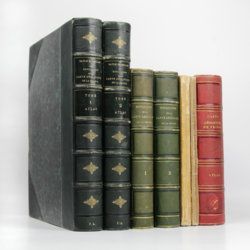
Dufrenoy, [O. P. A.] and [J. B. A. L. L.] Élie de Beaumont
Explication de la carte géologique de la France. Volumes I-IV (text and atlas), and two maps. [Complete].
Paris, Imprimerie Royale, Imprimerie Nationale, 1841-1879. Four volumes in seven, and a large map in six folded sheets, each ca. 70 x 205 cm (including borders) with linen covers. Large 4to (four text volumes; ca. 27.5 x 21.0 cm); folio (two atlas volumes, 26.8 x 35.7 cm). Tome premier: Paris, Imprimerie Royale, 1841. Large 4to. xxii, 825 pp., 71 text engravings (mainly profiles); Tome deuxième: Paris, Imprimerie Nationale, 1848. Large 4to. xii, 813 pp., 105 text engravings (mainly views and profiles), one large, folded chromolithographed geological map (finished by hand) of France (printed surface: 57 x 54 cm, and consisting of 15 smaller sections, mounted on linen and folded) bound in the rear; Tome troisième. Première partie (by Dufrénoy): Paris, Imprimerie Nationale, 1873. Large 4to. viii, 231 pp., 18 text engravings (mainly profiles). Printed wrappers. Tome quatrième. Seconde partie. Végétaux fossiles du terrain houiller (by Zeiller): Paris, Imprimerie Nationale, 1879. Large 4to. 185 pp. Printed wrappers; Tome quatrième. Atlas (in two volumes). Première partie. Fossiles principaux des terrains (by É. Bayle). Seconde partie. Végétaux fossiles du terrain houiller (by Zeiller): Paris, Imprimerie Nationale, 1878. Folio. Title page, half title to first part. 86 lithographed plates with explanatory text leaves, numbered I-LXXXVI; 90 lithographed plates with explanatory text leaves, numbered LXXXVII-CLXXVI (the last 16 on plants), for a total of 176 plates. Volumes I, II, and IV plate volumes in near uniform contemporary dark-green pebbled morocco over marbled boards. Spines with five gilt-stippled bands, and gilt title. Marbled endpapers. The text volumes with top edge gilt, atlases with marbled top edges. Text volumes III and IV in original printed wrappers. The large chromolithographed map in six sheets (approximately 218 x 223 cm) is contained in a contemporary, book-like crimson box with gilt-lettered spine, with raised bands and patterned paper sides.
Read more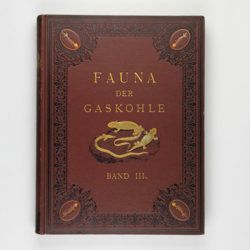
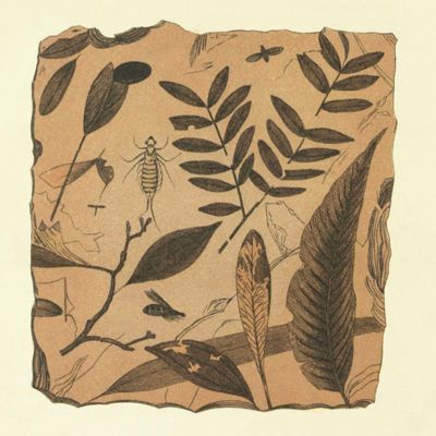
Fritsch, A.
Fauna der Gaskohle und der Kalksteine der Permformation Böhmens. Band I-IV. [Complete].
Prag, Selbstverlag and F. Řivnáč, 1879-1899 [1901?]. Four volumes in four. Folio (34.0 x 25.5 cm). 459 pp., lavishly illustrated with 167 mostly chromolithographed plates (several double-sized or larger, folded), and over 400 text engravings, of which some plate-sized. Volume I (1883): 182 pp., 48 plates (some larger, folded, a few plain), 160 text engravings; volume II (1889): 114 pp., 44 plates (several larger, folded; numbered 49-90, 80b, 81b), 79 text figures (numbered 117-188); vol. III (1895): 132 pp., 42 plates [several (much) larger; numbered 91-132], 122 text engravings (numbered 189-310); vol. IV (1901): 101 pp., full colour frontispiece, of a landscape with "Miriopoden"; 33 plates (numbered 133-165), 64 text engravings (numbered 311-394, and including phototypes of fossil animals and tracks, freshwater bivalves, and, e.g. the author at work). Original uniform brown cloth sumptuously embossed with black floral borders, and gilt vignettes depicting Permian amphibians, reptiles and fish. Marbled edges.
Read more
