Earth Sciences - Geology
153 items found

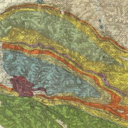
Granö, J. G.
Beiträge zur Kenntnis der Eiszeit in der Nordwestlichen Mongolei und einigen ihrer südsibirischen Grenzgebirge. Geomorphologische Studien aus den Jahren 1905, 1906, 1907 und 1909.
Helsingfors, J. Simelii [for the Geographical Society of Finland], 1910. Large 8vo (24.9 x 16.5 cm). iv, 230 pp.; seven large, folded coloured maps, 19 photographic plates. Later quarter calf over pictorial boards.
Read more

[Geological map]
Geognostische Karte von Württemberg [AND] Begleitworte zur geognostischen Specialkarte von Württemberg.
Stuttgart, Das Königliches Statistisch-topographisches Bureau, Kohlhammer, Kleeblatt, 1863-1892. With 54 chromolithographed folded geological maps, all mounted on linen, numbered 1-48, 50-55, in two original, uniform burgundy boxes with gilt title on the lid. [AND] the "Begleitworte" 34 parts in one. Large 8vo (25.7 x 19.5 cm). Stuttgart, Königlich Statistischen Landesambt, (1865-1892). ca. 1,000 pp., and five hand-coloured wood-engraved or lithographed maps or geological profiles, and four wood-engraved plates. Contemporary half cloth over marbled boards. Spine with gilt title, ornaments, and the Württemberg coat-of-arms; patterned endpapers, and marbled edges.
Read more
Fuchs, W.
Die Venetianer Alpen. Ein Beitrag zur Kenntniss der Hochgebirgte, met einen geognostischen Karte und Gebirgteprofilen in achtzehn Tafeln.
Solothurn, Jent & Gassmann, 1844. Oblong folio (29.8 x 35.5 cm), [4], 60 pp.; 18 mostly hand-coloured engraved maps and plates. Text pages bordered with putti and goddesses. 19th century iridescent blue blind cloth.
Read more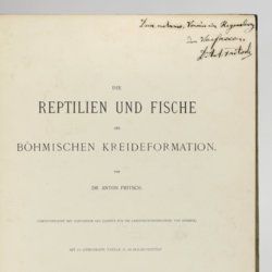
Fritsch, A. [J.]
Die Reptilien und Fische der böhmischen Kreideformation.
Prag, Verlag des Verfassers (Fr. Řivnáč), 1878. Large 4to (33.5 x 25.1 cm). [ii], 44, [ii] pp.; 66 text engravings; ten lithographed plates of which nine tinted, and two larger, folded. Original blind quarter linen over printed boards.
Read more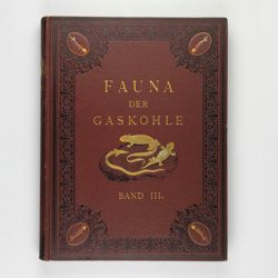
Fritsch, A.
Fauna der Gaskohle und der Kalksteine der Permformation Böhmens. Band I-IV. [Complete].
Prag, Selbstverlag and F. Řivnáč, 1879-1899 [1901?]. Four volumes in four. Folio (34.0 x 25.5 cm). 459 pp., lavishly illustrated with 167 mostly chromolithographed plates (several double-sized or larger, folded), and over 400 text engravings, of which some plate-sized. Volume I (1883): 182 pp., 48 plates (some larger, folded, a few plain), 160 text engravings; volume II (1889): 114 pp., 44 plates (several larger, folded; numbered 49-90, 80b, 81b), 79 text figures (numbered 117-188); vol. III (1895): 132 pp., 42 plates [several (much) larger; numbered 91-132], 122 text engravings (numbered 189-310); vol. IV (1901): 101 pp., full colour frontispiece, of a landscape with "Miriopoden"; 33 plates (numbered 133-165), 64 text engravings (numbered 311-394, and including phototypes of fossil animals and tracks, freshwater bivalves, and, e.g. the author at work). Original uniform brown cloth sumptuously embossed with black floral borders, and gilt vignettes depicting Permian amphibians, reptiles and fish. Marbled edges.
Read more
Forbes, J. D.
Reisen in den Savoyer Alpen und in anderen Theilen der Penninen-Kette, nebst Beobachtungen über die Gletscher.
Stuttgart, Schweizerbart, 1845. 8vo (21.0 x 13.3 cm). xii, 386 pp.; seven lithographed plates (of which one hand-coloured) and two folded lithographed maps depicting the Chamonix Alps. Early 20th-century cloth with mounted title and backstrip from original printed boards and spine.
Read more
Faber, F. C. Von
Die Kraterpflanzen Javas in physiologisch-ökologischer Beziehung.
Buitenzorg, 's Lands Plantentuin - Botanischer Garten, 1927. Large 8vo (24.1 x 17.0 cm). iv, 119 pp.; 12 text illustrations, 18 fine photographic plates. A unique pattered batik-cloth binding with gilt title on the spine and front board. Original printed front wrapper bound in.
Read more
Ettingshausen, C., von
Die Fossile Flora des Tertiär-Beckens von Bilin. I Theil. (Enthaltend die Thallophyten, Kryptogamischen Gefässpflanzen; Monokotyledonen, Coniferen, Julifloren und Oleraceen).
Wien, Kaiserlichen Akademie der Wissenschaften, 1867. 4to (29.6 x 23.1 cm). 95 pp.; 30 tinted lithographed plates. Later boards, printed label mounted on front board.
Read more
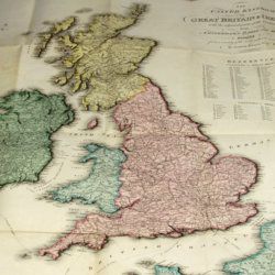
Enouy, J.
The United Kingdom of Great Britain & Ireland, with the adjacent parts of the Continent, from Amsterdam to Paris and Brest, compiled from a variety of the most authentic materials.
London, Samuel Leigh, 1818. Large, folded, coloured map (62.7 x 75.3 cm) of Great Britain and Ireland, and the continental coasts of the Channel and North Sea. In original reddish paper-covered boards, with printed label mounted.
Read more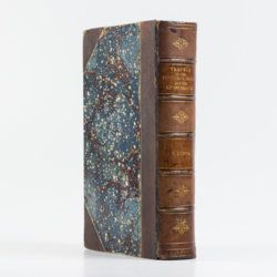
Duppa, R.
Travels on the continent, Sicily and the Lipari Islands. Second edition.
London, Longman, Rees, Orme, and Co., 1829. Large 8vo (26.8 x 17.2 cm). x, 494, [ii] pp.; 21 fine engraved plates, and 34 text engravings. Contemporary grained half morocco over marbled boards. Spine with five raised, stipple-gilted bands; compartments with gilt vignettes and a brown morocco label with gilt title.
Read more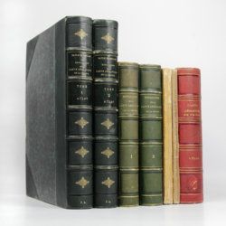
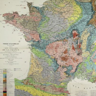
Dufrenoy, [O. P. A.] and [J. B. A. L. L.] Élie de Beaumont
Explication de la carte géologique de la France. Volumes I-IV (text and atlas), and two maps. [Complete].
Paris, Imprimerie Royale, Imprimerie Nationale, 1841-1879. Four volumes in seven, and a large map in six folded sheets, each ca. 70 x 205 cm (including borders) with linen covers. Large 4to (four text volumes; ca. 27.5 x 21.0 cm); folio (two atlas volumes, 26.8 x 35.7 cm). Tome premier: Paris, Imprimerie Royale, 1841. Large 4to. xxii, 825 pp., 71 text engravings (mainly profiles); Tome deuxième: Paris, Imprimerie Nationale, 1848. Large 4to. xii, 813 pp., 105 text engravings (mainly views and profiles), one large, folded chromolithographed geological map (finished by hand) of France (printed surface: 57 x 54 cm, and consisting of 15 smaller sections, mounted on linen and folded) bound in the rear; Tome troisième. Première partie (by Dufrénoy): Paris, Imprimerie Nationale, 1873. Large 4to. viii, 231 pp., 18 text engravings (mainly profiles). Printed wrappers. Tome quatrième. Seconde partie. Végétaux fossiles du terrain houiller (by Zeiller): Paris, Imprimerie Nationale, 1879. Large 4to. 185 pp. Printed wrappers; Tome quatrième. Atlas (in two volumes). Première partie. Fossiles principaux des terrains (by É. Bayle). Seconde partie. Végétaux fossiles du terrain houiller (by Zeiller): Paris, Imprimerie Nationale, 1878. Folio. Title page, half title to first part. 86 lithographed plates with explanatory text leaves, numbered I-LXXXVI; 90 lithographed plates with explanatory text leaves, numbered LXXXVII-CLXXVI (the last 16 on plants), for a total of 176 plates. Volumes I, II, and IV plate volumes in near uniform contemporary dark-green pebbled morocco over marbled boards. Spines with five gilt-stippled bands, and gilt title. Marbled endpapers. The text volumes with top edge gilt, atlases with marbled top edges. Text volumes III and IV in original printed wrappers. The large chromolithographed map in six sheets (approximately 218 x 223 cm) is contained in a contemporary, book-like crimson box with gilt-lettered spine, with raised bands and patterned paper sides.
Read more
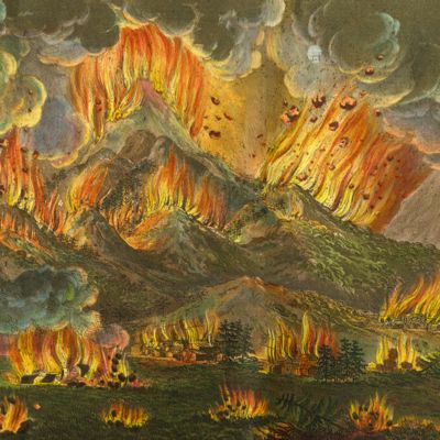
Dolomieu, D. [S. G. T.], De
Reise nach den liparischen Insuln oder Nachricht von den äolischen Insuln zur nähern Aufklärung der Geschichte der Vulkane. Nebst einer Abhandlung über eine Art von Luftvulkan, und einer andern über die Temperatur des Clima auf Maltha und die Verschiedenheit der wahren und fühlbaren Wärme.
Leipzig, Johann Gottfried Müller, 1783. 8vo (16.7 x 10.1 cm). 210, [ii] pp. Contemporary marbled boards, small leather label with gilt title on the spine. Edges yellow.
Read more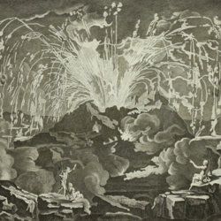
Diderot, D. and J. d'Alembert (eds.)
Encyclopédie ou dictionnaire raisonné des sciences, des arts et des métiers, par une société de gens de lettres mis en ordre par Mons. Diderot. Histoire naturelle. Règne mineral.
Paris, Diderot et d'Alembert, 1768. Folio (43.2 x 27.2 cm). 4 pp., 130 plates (partly folded). Disbound.
Read more
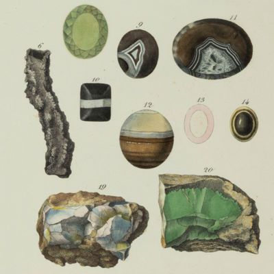
[Dezallier d'Argenville, A. J. D.]
l'Histoire naturelle éclaircie dans une de ses parties principales, l'Oryctologie, qui traite des terres, des pierres, des métaux, des minéraux, et autres fossiles. Ouvrage dans lequel on trouve une nouvelle méthode Latine & Françoise de les diviser, & une notice critique des principaux ouvrages qui ont paru sur ces matières.
Paris, De Bure, 1755. 4to (28.6 x 21.1 cm). Engraved frontispiece, [6], xvi, 560 [1] pp.; 26 engraved plates. Contemporary full mottled calf, richly floral gilt spine with five raised bands and gilt lettered red morocco label. Marbled endpapers, edged red.
Read more
Devèze de Chabrol, J. S. and J. B. Bouillet
Essai géologique et minéralogique sur les environs d'Issoire, département du Puy-de-Dôme, et principalement sur la Montagne de Boulade.
Clermont-Ferrand, Thibaud-Landriot, 1827. Folio (41.0 x 26.2 cm). xii, 104 pp.;hand-coloured lithographed geological map and hand-coloured profile, and 30 lithographed plates depicting vertebrates and several tables, including one very large, folded in the text. Contemporary half morocco over marbled boards. Spine with gilt lines and title. Marbled endpapers; speckled edges.
Read more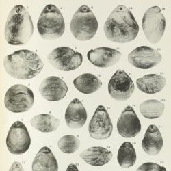
Davidson, T.
A monograph of British Cretaceous Brachiopoda. [AND] M. R. Sahni, the Terebratulidae of the British Chalk. [AND] N. E. Pettitt, The Rhynchonellidae of the British Chalk.
London, The Palaeontographical Society, 1854-1953. 4to (27.0 x 20.6 cm). 205 pp., 21 [12, 9] lithographed plates; 62 pp.; ten plates; 58 pp., three plates. Later half calf, spine with five raised, gilt bordered bands, and gilt titles on spine. Edges speckled red.
Read more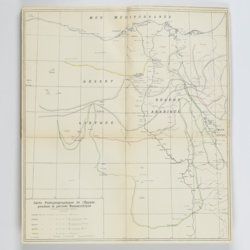
Cuvillier, J.
Revision du nummulitique Égyptien. [AND] Nouvelle contribution à la paléontologie du nummulitique Égyptien. [AND] Étude complémentaire sur la paléontologie du nummulitique Égyptien. [Complete].
Le Caire, Institut d'Egypte, 1930-1935. Three parts in three. 4to (27.5 x 22.0 cm). 530 pp. [371; 76; 83]; 37 plates [24; 8; 5], one folded map. Original, uniform printed front wrappers.
Read more
Cuvier, G. [L. C. F. D.] and A. Brongniart
Description géologique des environs de Paris, par MM. G. Cuvier et Alex. Brongniart. Nouvelle édition, dans laquelle on a inséré la descrition d'un grand nombre de lieux de l'Allemagne, de la Suisse, de l'Italie, etc., qui présentent des terrains analogues a ceux du Bassin de Paris. Avec 2 cartes et 16 planches représentant les coupes de ces terrains et beaucoup des coquilles fossiles qu'ils renferment, et une table alphabétique de tous les lieux décrits ou seulement cités.
Paris, G. Dufour et E. d'Ocagne, 1822. 4to (29.3 x 22.2 cm). ix, 428 pp.; one brightly hand-coloured geological map of the surroundings of Paris, and 17 lithographed plates, including one hand-coloured geological map of the basins of London and Paris. Contemporary half calf over marbled boards. Spine with five raised, gilt-ornamented bands; compartments rich gilt, and with two morocco labels (red and blue) with gilt title.
Read more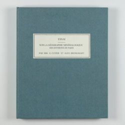
Cuvier, G. and A. [T.] Brongniart
Essai sur la géographie minéralogique des environs de Paris. Proof copy of the introductions, with corrections by Brogniart.
Paris, Institut Impériale de France, [1809 or 1810]. 4to (25.0 x 20.0 cm). 33 pp. Not bound. In a 20th century blue hardcover paper drop-box (26.8 x 22.0 cm) with printed label on the top board.
Read more
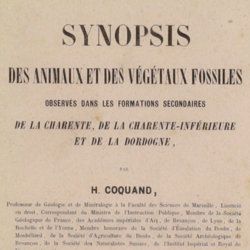
Coquand, H. [J. B.]
Synopsis des animaux et des végétaux fossiles observés dans les formations secondaires de la Charente, de la Charente-inférieure et de la Dordogne.
Marseille, Barlatier-Feissat et Demonchy [for the author], 1860. 8vo (22.6 x 14.7 cm). 146 pp.; original printed wrappers.
Read more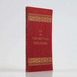
Collet, O. [J. A.]
l'Or aux Indes orientales Néerlandaises. Étude sur l'etat actuel de l'industrie aurifere.
Batavia, G. Kolff, 1889. Small 4to (24.4 x 16.3 cm). 51 pp. Original crimson pebbled and embossed cloth with gilt ornamental bands and gilt title on the front board. Floral-pattered endpapers.
Read more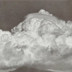
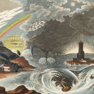
[Clouds; Wolken]
Internationaler Atlas der Wolken und Himmelsansichten. Internationales Meteorologisches Komitee. Kommission für das Studium der Wolken. Vol 1: Allgemeiner Atlas.
Paris, Office National Méteorologique, 1932. Large, thick 4to (32.0 x 24.5 x 4.0 cm). ix, 108 pp. In original printed wrappers & 174 loose-leaved plates. In original printed portfolio. Contained in cardboard slipcase.
Read more
Clairaut, J. B., a.o.
Miscellanea Berolinensia ad incrementum scientiarum ex scriptis Societati Regiae Scientiarum exhibitis. Edita, continuatio III, sive Tomus IV. Cum figuris et indice materiarum.
Berolini, Johann Andreas Rüdiger, 1734. Small 4to (20.5 x 16.0 cm). vi, 405 pp.; 11 mostly folded engraved plates. Contemporary full mottled calf. Spine with five raised, gilt-ornamented bands; compartments rich gilt, red morocco label with gilt title. Edges speckled red.
Read more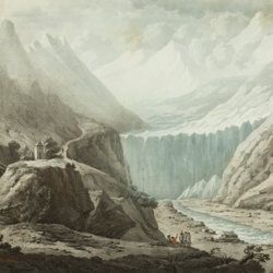
Catullo, T. A.
Trattato sopra la costituzione geognostico-fisica dei terreni alluviani o postdiluviani delle provincie Venete.
Padova, Cartallier e Sicca, 1838. 8vo (21.2 x 13.3 cm). Title page with engraved vignette, [iv], 512 pp.; several tables in the text. Mid-19th-century pebbled cloth. Gilt title on the spine.
Read more
Carez, L. [L. H.]
La géologie des Pyrénées Françaises.
Paris, Imprimerie Nationale, 1903-1909. In six volumes, including the supplement. Large 4to (29.5 x 22.6 cm). 3,908 [ix, 3,899] pp.; 39 mainly geological folded maps or profiles (six in full-colour), and heliogravures (photogravures), some with printed overlays. Uniform contemporary half calf over marbled boards. Spines with four raised bands and gilt title.
Read more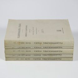
Canavari, M. (ed.)
Palaeontologia della Somalia. Fossili raccolti dalle Missioni Stefanini-Paoli (1913) e Stefanini-Puccioni (1924) e da altri.
Pisa, Museo Geologico della R. Università di Pisa, 1931-1939 [REPRINT Bologna, Forni, 1969]. In five volumes. 4to (31.2 x 21.4 cm). 1,115 pp. [216; 192; 301; 89; 270, 47]; 111 plates [17; 24; 26; 12; 27, 5]; numerous text illustrations. Original uniform printed wrappers.
Read more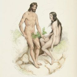
Buffon, [G. L. L. Comte de]
Oeuvres complètes de Buffon avec la nomenclature Linnéenne et la classification de Cuvier. Revues sur l'édition in 4to de l'Imprimerie Royale et annotées par M. Flourens.
Paris, Garnier frères, 1853-1855. In 12 volumes. Very large 8vo (26.7 x 17.8 cm). Text with one engraved frontispiece, one hand-coloured frontispiece, one engraved portrait of Buffon, and 160 hand-coloured engraved plates and maps, for a total of 163 plates outside the text. Contemporary uniform dark blue half calf over pebbled boards; spines with four raised bands, compartments with gilt vignettes and titles. Iridescent endpapers. All edges gilt.
Read more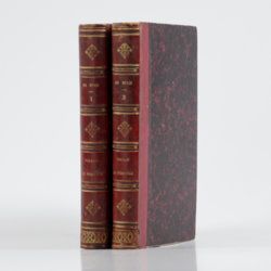
Buch, L. de
Voyage en Norvège et en Laponie, fait dans les années 1806, 1807 et 1808. Traduit de l`Allemand par J. B. B. Eyriés. Précédé d`une introduction de M. A. de Humboldt. Suivi d`un mémoire de M. de Buch, sur la limite des neiges perpétuelles dans le Nord, et enrichi de cartes et de coupes de terrein.
Paris, Gide fils, 1816. Two volumes in two. 8vo (19.9 x 12.6 cm). 953 pp. [xxiv, 472; 457]; three engraved maps, of which two large, folded. Uniform red calf over marbled boards. Spines with gilt ornamental bands, vignettes, and title. Sprinkled edges.
Read more
Brongniart, A.
Traité des arts céramiques ou des poteries, considérées dans leur histoire, leur pratique et leur théorie.
Paris, Béchet Jeune et Mathias, 1844. In three parts. 8vo (two text volumes, 20.7 x 13.5 cm), oblong 4to (atlas, 27.2 x 21.0 cm). xxvii, 592, 706 pp.; one engraved map, one engraved vignette facing preface, 109 woodcuts and oblong atlas with nine tables (three folded, pp. 1-29) and "explication des planches" (pp. 33-80) including an important list of porcelain signatures from all over Europe and 60 fine engraved plates. Contemporary uniform half calf over marbled boards. Spines with gilt lines and title. Marbled flyleaves.
Read more
Brard, C. P.
Traité des pierres précieuses, des porphyres, granits, marbres, albatres, et autres roches propres a recevoir le poli et a orner les monumens publics et les edifices particuliers; suivi de la description des machines dont on se sert pour tailler, polir, et travailler ces pierres; et d'un coup d'oeil général sur l'art du marbrier; ouvrage utile aux joailliers, lapidaires, bijoutiers; aux architectes, décorateurs, etc., etc.
Paris, F. Schoell, 1808. 8vo (21.0 x 13.4 cm). Half title, title pages, xxvii, 565 pp.; eight [5; 3] engraved plates of which several are larger, folded. Near contemporary half-vellum over marbled boards. Spine with green morocco label with gilt lines and title. Marbled endpapers.
Read more
Bourrit, M. T.
Description des Alpes, Pennines et Rhetiennes; dédiée a.s.m. très-chrétienne Louis XVI, roi de France et de Navarre. Tome premier - second. [Complete].
Genève, J. P. Bonnant, 1781. In two volumes. 8vo (21.5 x 13.8 cm). xix, 247 pp.; [ii], 285 pp.; eight engraved plates, mainly of glaciers, and one folded engraved map of the Alps, several wood engraved vignettes in the text. Original uniform blind publishers' wrappers. Spines renewed with later printed labels. Contained in a later blue cloth slipcase (23.2 x 15.8 x 6.9 cm) with black morocco label with gilt title.
Read more
Bourguet, [L.]
Traité des pétrifications. Nouvelle édition, corrigée et augmentée.
Paris, Claude-Antoine Jombert, 1778. 8vo (19.7 x 12.3 cm). Half-title, title page, 349 pp. (xvii, 326, [vii], and 4; 16 with advertisements); 441 engravings on 60 plates. 19th-century half calf over marbled boards. Spine with gilt ornamental lines and title. Marbled endpapers. Speckled edges.
Read more
Bonnard, A. H. De
Sur la constance des faits géognostiques, qui accompagnent le gisement du terrain d'Arkose à l'est du Plateau Central de la France.
Paris, Mme Huzard, 1828. 8vo (21.5 x 13.3 cm). 106 pp.; three folded engraved geological profiles. Contemporary polished half calf. Spine with five raised, gilt-bordered bands and gilt title on red morocco shield. Marbled flyleaves.
Read more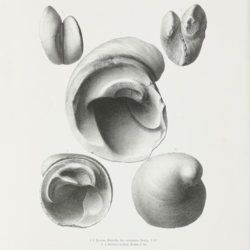
Boehm, G.
Palaeontologische Mittheilungen aus dem Museum des Koenigliche Bayerische Staates. Zweiter Band, vierte Abtheilung. Die Bivalven der Stramberger Schichten.
Cassel [Kassel], Gustav Fischer, 1883. Folio (44.2 x 31.5 cm), Title page; 18 fine, lithographed plates. In original green portfolio with printed title page mounted.
Read more
[Bertrand, B. N.]
Elemens d'oryctologie ou distribution méthodique des fossiles.
Neuchatel, Société Typographique, 1773. 8vo (18.8 x 11.5 cm). xxxix, 137, xxii pp.; 16 double, folded tables. Contemporary full calf. Spine with four raised bands. Rich gilt floral compartments, red morocco label with gilt title. Edges red.
Read more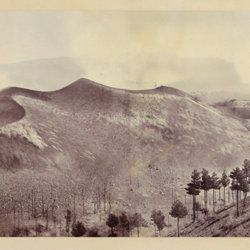
Berthier, P. [M.]
Photographic panorama of Mount Etna.
Paris, Paul Berthier, 1865. Very large board (93.0 x 45.0 cm), with original mounted albumen silver prints (panorama, in two parts of 25.0 x 36.2 cm and 25.0 x 35.0 cm, for a continuous image with a total width of 71.2 cm). Paul Berthier printed studio label pasted on verso.
Read more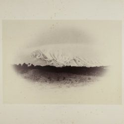
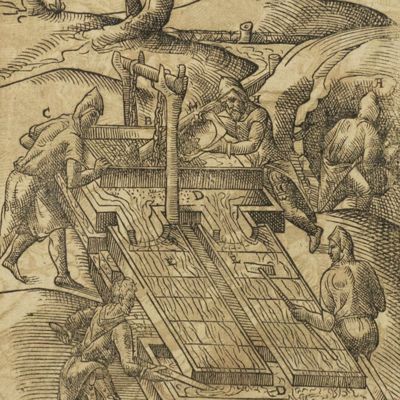
Belon, P.
Les observations de plusieurs singularitez et choses memorables, trouvees en Grece, Asie, Iudée, Egypte, Arabie, & autres pays estranges, redigées en trois liures. Reueuz de nouveau & augmentez de figures. Le catalogue contenant le plus notables choses, est en la page fuyuante.
Paris, H. de Marnef & G. Cavellat, 1588. 4to (22.1 x 15.4 cm). [xiv], 468, [ii] pp.; numerous woodcuts, some page-sized. 18th-century full tree calf. Spine with five raised bands, compartments rich gilt with floral patterns. Red morocco label with gilt title. Marbled endpapers. All edges red.
Read more
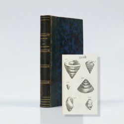
Belgrand, [M. F.] E.
Histoire générale de Paris. La Seine. I. Le bassin Parisien aux âges antéhistoriques.
Paris, Imprimerie Impériale, 1869. In three parts (Texte, Atlas de Paléontologie, and Planches de Géologie et de Conchyliologie). Large 4to and folio (33.8 x 23.9 cm). Texte: cvi, 289 pp., four double-sized coloured maps, 36 engraved text figures, five tissue-guarded plates (four profiles and one with stone age axes); Atlas: 82 [46, a-d] pp.; seven text engravings, 86 plates [1-79, 29bis, 48bis, 53bis, 59bis, 59ter, 62bis, 62ter, 78bis) being tissue guarded heliogravures of mammalian bones, including human skulls, etc., and stone age tools. Géologie and Conchyliologie, 32 pp. Three lithographed plates of shells, three very large folded, coloured geological profiles (numbered 5-7, being a suite to the maps in the text part). All in original green, printed boards or wrappers. Not in Nissen, ZBI.
Read more
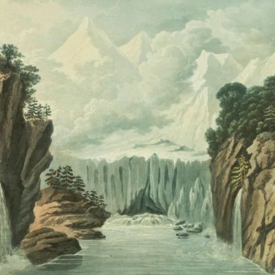
Belanger, L. and P. Vanlerberghe and S. Malgo
View of the torrent of the Lutschinen, and of the glaciers where it takes its source – Vue du torrent de la Lutschinen en Suisse, et des glaciers ou il prend sa source.
London, G. & W. Nicoll, 1800. Broadsheet (71.0 x 56.0 cm). Aquatint, finished by hand.
Read more
