Earth Sciences - Geology
155 items found
Arnold, F.
Halenza's neuestes Rhein-Panorama von Mainz bis Cöln. Einziges, durch die Berliner und Frankfurter Künstler gefässtes Urtheil, anerkanntes Kustwerk. Panorama du Rhin depuis Mayence jusq'à Cologne. Panorama of the Rhine, from Mentz to Cologne. [Complete with the rare text volume].
Mainz, J. Halenza, [1880]. Two parts in two. 8vo (text: 26.4 x 16.2 cm). Title page, 24 pp. (in English). Panorama: One folding lithographed view by F. Foltz (27 x 230 cm). Contained in original printed boards with the German title on one board, and the French/English titles on the other.
Read more

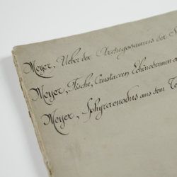
Meyer, H. von
Ueber den Archegosaurus der Steinkohlenformation [AND] Fische, Echinodermen und andere Versteinerungen aus dem Muschelkalk Oberschlesiens [AND] Sphyraenodus aus dem Tertiärsande von Flonheim.
Cassel, Palaeontographica, 1849. 4to (29.2 x 23.0 cm). 76 [5; 68; 3] pp.; four engraved plates. Contemporary wrappers with the titles added in a neat old hand.
Read more
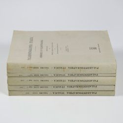
Canavari, M. (ed.)
Palaeontologia della Somalia. Fossili raccolti dalle Missioni Stefanini-Paoli (1913) e Stefanini-Puccioni (1924) e da altri.
Pisa, Museo Geologico della R. Università di Pisa, 1931-1939 [REPRINT Bologna, Forni, 1969]. In five volumes. 4to (31.2 x 21.4 cm). 1,115 pp. [216; 192; 301; 89; 270, 47]; 111 plates [17; 24; 26; 12; 27, 5]; numerous text illustrations. Original uniform printed wrappers.
Read more
Pervinquière, L.
Études de paléontologie Tunisienne - I - Céphalopodes des terrains secondaires. Texte - Atlas. [Complete].
Paris, F. R. De Rudeval [for the Regence de Tunis - Protectorat Français, Direction générale des Travaux Publics], 1907. Two parts in two. Large 4to/Folio (31.0 x 23.0 cm). v, 438 pp. 158 text illustrations, 28 heliotype plates (several double-sized). Uniform printed wrappers.
Read more
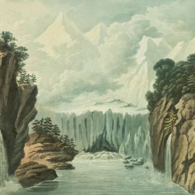
Forbes, J. D.
Reisen in den Savoyer Alpen und in anderen Theilen der Penninen-Kette, nebst Beobachtungen über die Gletscher.
Stuttgart, Schweizerbart, 1845. 8vo (21.0 x 13.3 cm). xii, 386 pp.; seven lithographed plates (of which one hand-coloured) and two folded lithographed maps depicting the Chamonix Alps. Early 20th-century cloth with mounted title and backstrip from original printed boards and spine.
Read more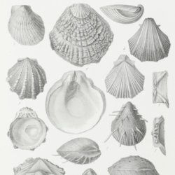
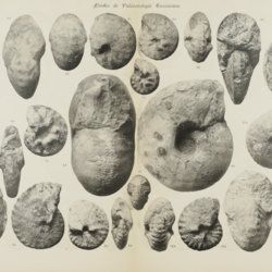
Pictet, F.
Traité de Paléontologie où histoire naturelle des animaux fossiles considérés dans leurs rapports zoologiques et géologiques. [Text and atlas, complete].
Paris, Baillière, 1853-1857. Five parts in five. 8vo (four text parts; 20.7 x 12.7 cm) and 4to (atlas; 30.7 x 23.5 cm). 2742 pp. [I: xiv, 584; II: 727; III: 654; IV: xvi, 768; Atlas; 77]; 110 fine lithographed plates. contemporary uniform pebbled half morocco over marbled boards. Spines with gilt-bordered bands, and gilt title. Marbled endpapers. Speckled edges.
Read more
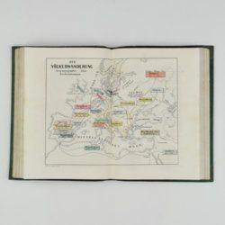
Hochstetter, F. von and A. Petermann.
The geology of New Zealand: in explanation of the geographical and topographical atlas of New Zealand by Dr. F. Von Hochstetter and Dr. A. Petermann, from the Scientific Publications of the Novara Expedition. Translated by C. F. Fischer. Also, lectures by Dr. F. Hochstetter delivered in New Zealand.
Auckland, T. Delattre, 1864. 8vo (21.0 x 13.6 cm). Title page, 113 pp. Original grained red cloth with gilt title on the front board.
Read more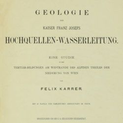
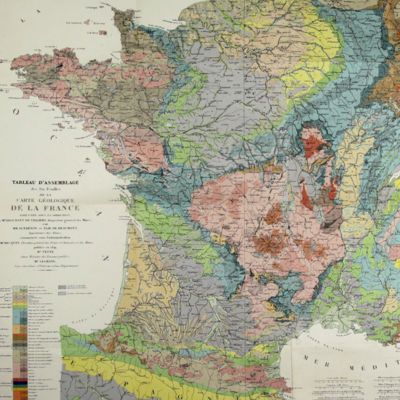
Karrer, F.
Geologie der Kaiser Franz Josefs Hochquellen-Wasserleitung. Eine Studie in den Tertiär-Bildungen am Westrande des alpinen Theiles der Niederung von Wien.
Wien, Hölder, 1877. Large 4to (33.5 x 25.5 cm). xiii, 420 pp.; 96 text engravings, 20 folded profiles, maps and lithographed plates, mostly coloured and several very large (size up to 32 x 100 cm), seven folded charts and tables. Later half cloth with paper label on the spine.
Read more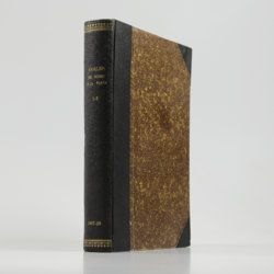
Rothpletz, A.
Ein geologischer Querschnitt durch die Ost-Alpen nebst Anhang über die sog. Glarner Doppelfalte.
Stuttgart, E. Schweizerbart (E. Koch), 1894. 8vo (22.4 x 15.4 cm). iv, 208 pp.; two full colour folded profiles of which one measuring 22.5 x 352.0 cm (!), 115 text illustrations. Contemporary half cloth over marbled boards. Gilt lines and two red morocco labels with gilt title on the spine. Edges speckled.
Read more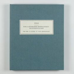
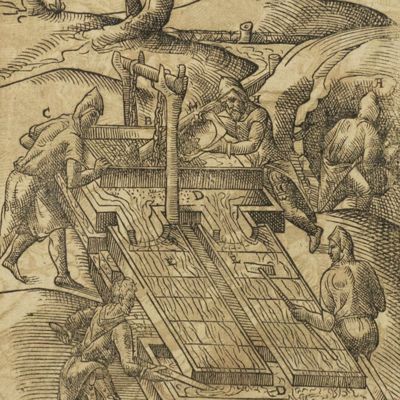
Cuvier, G. and A. [T.] Brongniart
Essai sur la géographie minéralogique des environs de Paris. Proof copy of the introductions, with corrections by Brogniart.
Paris, Institut Impériale de France, [1809 or 1810]. 4to (25.0 x 20.0 cm). 33 pp. Not bound. In a 20th century blue hardcover paper drop-box (26.8 x 22.0 cm) with printed label on the top board.
Read more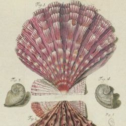
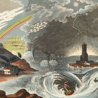
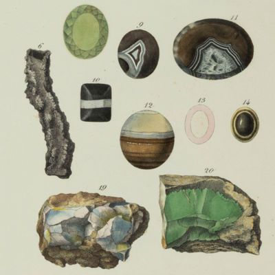
Martini, [F. H. W.] (ed.)
Beschäftigungen der Berliner Gesellschaft Naturforschender Freunde. Zweeter Band.
Berlin, Joachim Pauli, 1776. 8vo (19.2 x 11.2 cm). Title page with finely engraved vignette; xl, 607 pp.; 14 folded, engraved plates of which ten in original hand-colouring (plates numbered I-XIII, IXA). Original speckled paper covered boards with paper label on the spine. Speckled edges.
Read more
Allemann, F.
Geologische Karte Fürstentum Liechtenstein.
[Vaduz], Regierung des Fürstentums Liechtenstein, 1953. Large (102.0 x 67.0 cm), folded map, consisting of 25 rectangular sheets in full colour, mounted on linen. Handwritten and stamped label on the front-facing part of the linen map verso.
Read more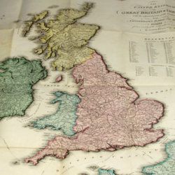
Enouy, J.
The United Kingdom of Great Britain & Ireland, with the adjacent parts of the Continent, from Amsterdam to Paris and Brest, compiled from a variety of the most authentic materials.
London, Samuel Leigh, 1818. Large, folded, coloured map (62.7 x 75.3 cm) of Great Britain and Ireland, and the continental coasts of the Channel and North Sea. In original reddish paper-covered boards, with printed label mounted.
Read more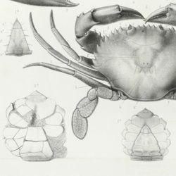
Milne-Edwards, A.
Histoire des crustacés podophthalmaires fossiles.
Paris, Martinet, 1861. 4to (26.5 x 21.5 cm). 222 pp.; one folding table, 16 engraved or lithographed plates (three larger, folded). Later marbled boards with printed label on the front board. Original printed wrappers bound in.
Read more
